You are here: Home > Network List > TA - USArray Transportable Network (new EarthScope stations) Stations List
> Station G05D Wamic, OR, USA > Earthquake Result Viewer
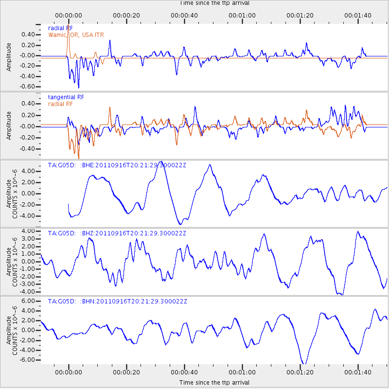
G05D Wamic, OR, USA - Earthquake Result Viewer
*The percent match for this event was below the threshold and hence no stack was calculated.
| Earthquake location: |
Off East Coast Of Honshu, Japan |
| Earthquake latitude/longitude: |
40.2/143.2 |
| Earthquake time(UTC): |
2011/09/16 (259) 20:11:16 GMT |
| Earthquake Depth: |
35 km |
| Earthquake Magnitude: |
5.5 MB, 5.8 MW |
| Earthquake Catalog/Contributor: |
WHDF/NEIC |
|
| Network: |
TA USArray Transportable Network (new EarthScope stations) |
| Station: |
G05D Wamic, OR, USA |
| Lat/Lon: |
45.24 N/121.32 W |
| Elevation: |
592 m |
|
| Distance: |
66.2 deg |
| Az: |
50.251 deg |
| Baz: |
303.58 deg |
| Ray Param: |
$rayparam |
*The percent match for this event was below the threshold and hence was not used in the summary stack. |
|
| Radial Match: |
85.05991 % |
| Radial Bump: |
400 |
| Transverse Match: |
65.97894 % |
| Transverse Bump: |
400 |
| SOD ConfigId: |
414626 |
| Insert Time: |
2012-01-23 14:22:26.777 +0000 |
| GWidth: |
2.5 |
| Max Bumps: |
400 |
| Tol: |
0.001 |
|
Signal To Noise
| Channel | StoN | STA | LTA |
| TA:G05D: :BHZ:20110916T20:21:29.300022Z | 1.240446 | 1.4020992E-6 | 1.1303187E-6 |
| TA:G05D: :BHN:20110916T20:21:29.300022Z | 0.56005436 | 8.982139E-7 | 1.6037977E-6 |
| TA:G05D: :BHE:20110916T20:21:29.300022Z | 1.8370204 | 4.7919953E-6 | 2.6085693E-6 |
| Arrivals |
| Ps | |
| PpPs | |
| PsPs/PpSs | |


