You are here: Home > Network List > TA - USArray Transportable Network (new EarthScope stations) Stations List
> Station 334A Lometa, TX, USA > Earthquake Result Viewer
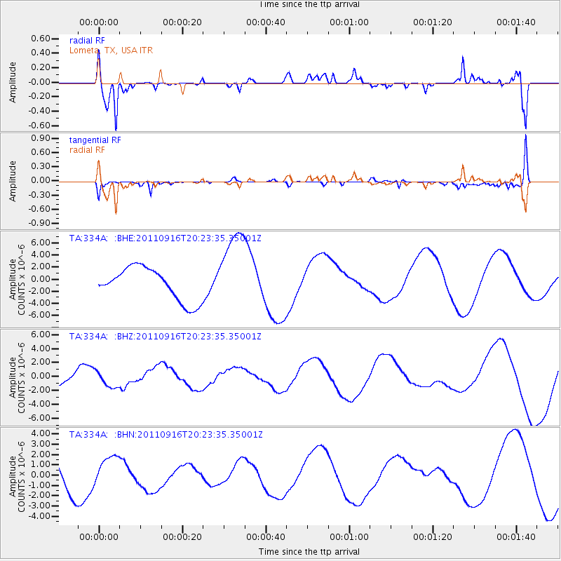
334A Lometa, TX, USA - Earthquake Result Viewer
*The percent match for this event was below the threshold and hence no stack was calculated.
| Earthquake location: |
Off East Coast Of Honshu, Japan |
| Earthquake latitude/longitude: |
40.2/143.2 |
| Earthquake time(UTC): |
2011/09/16 (259) 20:11:16 GMT |
| Earthquake Depth: |
35 km |
| Earthquake Magnitude: |
5.5 MB, 5.8 MW |
| Earthquake Catalog/Contributor: |
WHDF/NEIC |
|
| Network: |
TA USArray Transportable Network (new EarthScope stations) |
| Station: |
334A Lometa, TX, USA |
| Lat/Lon: |
31.33 N/98.24 W |
| Elevation: |
389 m |
|
| Distance: |
88.8 deg |
| Az: |
48.765 deg |
| Baz: |
317.719 deg |
| Ray Param: |
$rayparam |
*The percent match for this event was below the threshold and hence was not used in the summary stack. |
|
| Radial Match: |
82.157104 % |
| Radial Bump: |
372 |
| Transverse Match: |
45.04317 % |
| Transverse Bump: |
205 |
| SOD ConfigId: |
414626 |
| Insert Time: |
2012-01-23 14:22:54.990 +0000 |
| GWidth: |
2.5 |
| Max Bumps: |
400 |
| Tol: |
0.001 |
|
Signal To Noise
| Channel | StoN | STA | LTA |
| TA:334A: :BHZ:20110916T20:23:35.35001Z | 0.68624246 | 1.1423045E-6 | 1.6645787E-6 |
| TA:334A: :BHN:20110916T20:23:35.35001Z | 0.91538906 | 1.6696098E-6 | 1.8239346E-6 |
| TA:334A: :BHE:20110916T20:23:35.35001Z | 2.5199692 | 6.8283534E-6 | 2.7096971E-6 |
| Arrivals |
| Ps | |
| PpPs | |
| PsPs/PpSs | |


