You are here: Home > Network List > TA - USArray Transportable Network (new EarthScope stations) Stations List
> Station E31A Nome, ND, USA > Earthquake Result Viewer
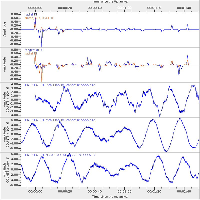
E31A Nome, ND, USA - Earthquake Result Viewer
*The percent match for this event was below the threshold and hence no stack was calculated.
| Earthquake location: |
Off East Coast Of Honshu, Japan |
| Earthquake latitude/longitude: |
40.2/143.2 |
| Earthquake time(UTC): |
2011/09/16 (259) 20:11:16 GMT |
| Earthquake Depth: |
35 km |
| Earthquake Magnitude: |
5.5 MB, 5.8 MW |
| Earthquake Catalog/Contributor: |
WHDF/NEIC |
|
| Network: |
TA USArray Transportable Network (new EarthScope stations) |
| Station: |
E31A Nome, ND, USA |
| Lat/Lon: |
46.56 N/97.89 W |
| Elevation: |
427 m |
|
| Distance: |
77.8 deg |
| Az: |
38.18 deg |
| Baz: |
316.705 deg |
| Ray Param: |
$rayparam |
*The percent match for this event was below the threshold and hence was not used in the summary stack. |
|
| Radial Match: |
90.25788 % |
| Radial Bump: |
400 |
| Transverse Match: |
75.79108 % |
| Transverse Bump: |
400 |
| SOD ConfigId: |
414626 |
| Insert Time: |
2012-01-23 14:25:21.502 +0000 |
| GWidth: |
2.5 |
| Max Bumps: |
400 |
| Tol: |
0.001 |
|
Signal To Noise
| Channel | StoN | STA | LTA |
| TA:E31A: :BHZ:20110916T20:22:38.999973Z | 1.5651965 | 2.945936E-6 | 1.8821509E-6 |
| TA:E31A: :BHN:20110916T20:22:38.999973Z | 1.3324277 | 3.045912E-6 | 2.2859865E-6 |
| TA:E31A: :BHE:20110916T20:22:38.999973Z | 0.9191744 | 1.4494076E-6 | 1.5768582E-6 |
| Arrivals |
| Ps | |
| PpPs | |
| PsPs/PpSs | |


