You are here: Home > Network List > TA - USArray Transportable Network (new EarthScope stations) Stations List
> Station L37A Phoenix Point, Boone, IA, USA > Earthquake Result Viewer
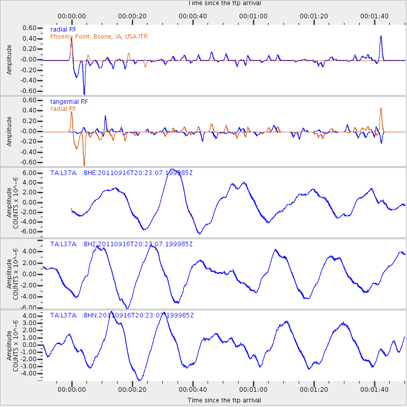
L37A Phoenix Point, Boone, IA, USA - Earthquake Result Viewer
*The percent match for this event was below the threshold and hence no stack was calculated.
| Earthquake location: |
Off East Coast Of Honshu, Japan |
| Earthquake latitude/longitude: |
40.2/143.2 |
| Earthquake time(UTC): |
2011/09/16 (259) 20:11:16 GMT |
| Earthquake Depth: |
35 km |
| Earthquake Magnitude: |
5.5 MB, 5.8 MW |
| Earthquake Catalog/Contributor: |
WHDF/NEIC |
|
| Network: |
TA USArray Transportable Network (new EarthScope stations) |
| Station: |
L37A Phoenix Point, Boone, IA, USA |
| Lat/Lon: |
42.12 N/93.75 W |
| Elevation: |
312 m |
|
| Distance: |
83.1 deg |
| Az: |
38.931 deg |
| Baz: |
319.711 deg |
| Ray Param: |
$rayparam |
*The percent match for this event was below the threshold and hence was not used in the summary stack. |
|
| Radial Match: |
71.79293 % |
| Radial Bump: |
400 |
| Transverse Match: |
34.47455 % |
| Transverse Bump: |
305 |
| SOD ConfigId: |
414626 |
| Insert Time: |
2012-01-23 14:26:29.739 +0000 |
| GWidth: |
2.5 |
| Max Bumps: |
400 |
| Tol: |
0.001 |
|
Signal To Noise
| Channel | StoN | STA | LTA |
| TA:L37A: :BHZ:20110916T20:23:07.199985Z | 2.5969956 | 2.8953E-6 | 1.1148651E-6 |
| TA:L37A: :BHN:20110916T20:23:07.199985Z | 0.9770201 | 1.0898954E-6 | 1.1155302E-6 |
| TA:L37A: :BHE:20110916T20:23:07.199985Z | 2.2359273 | 5.7223474E-6 | 2.5592724E-6 |
| Arrivals |
| Ps | |
| PpPs | |
| PsPs/PpSs | |


