You are here: Home > Network List > CI - Caltech Regional Seismic Network Stations List
> Station BAR Barrett, Tecate, CA, USA > Earthquake Result Viewer
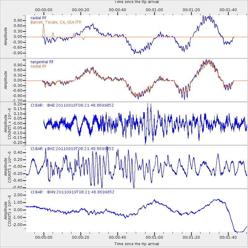
BAR Barrett, Tecate, CA, USA - Earthquake Result Viewer
*The percent match for this event was below the threshold and hence no stack was calculated.
| Earthquake location: |
Fox Islands, Aleutian Islands |
| Earthquake latitude/longitude: |
52.0/-172.0 |
| Earthquake time(UTC): |
2011/09/19 (262) 08:14:14 GMT |
| Earthquake Depth: |
31 km |
| Earthquake Magnitude: |
5.5 MB, 5.1 MS, 5.7 MW, 5.6 MW |
| Earthquake Catalog/Contributor: |
WHDF/NEIC |
|
| Network: |
CI Caltech Regional Seismic Network |
| Station: |
BAR Barrett, Tecate, CA, USA |
| Lat/Lon: |
32.68 N/116.67 W |
| Elevation: |
521 m |
|
| Distance: |
44.0 deg |
| Az: |
93.754 deg |
| Baz: |
313.038 deg |
| Ray Param: |
$rayparam |
*The percent match for this event was below the threshold and hence was not used in the summary stack. |
|
| Radial Match: |
49.758915 % |
| Radial Bump: |
400 |
| Transverse Match: |
49.546814 % |
| Transverse Bump: |
400 |
| SOD ConfigId: |
414626 |
| Insert Time: |
2012-01-27 13:30:43.887 +0000 |
| GWidth: |
2.5 |
| Max Bumps: |
400 |
| Tol: |
0.001 |
|
Signal To Noise
| Channel | StoN | STA | LTA |
| CI:BAR: :BHZ:20110919T08:21:48.869985Z | 1.5121478 | 2.4358303E-7 | 1.6108415E-7 |
| CI:BAR: :BHN:20110919T08:21:48.869985Z | 0.4591114 | 2.0985749E-7 | 4.5709493E-7 |
| CI:BAR: :BHE:20110919T08:21:48.869985Z | 1.2418178 | 5.0366612E-8 | 4.0558778E-8 |
| Arrivals |
| Ps | |
| PpPs | |
| PsPs/PpSs | |


