You are here: Home > Network List > TA - USArray Transportable Network (new EarthScope stations) Stations List
> Station J04D Umpqua National Forest, Toketee, OR, USA > Earthquake Result Viewer
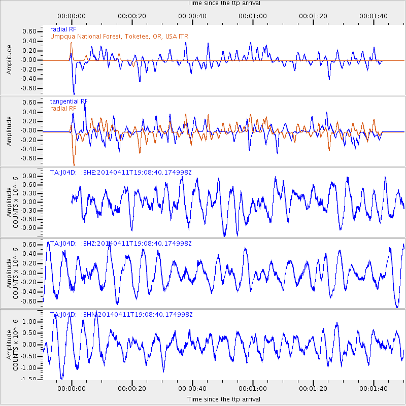
J04D Umpqua National Forest, Toketee, OR, USA - Earthquake Result Viewer
*The percent match for this event was below the threshold and hence no stack was calculated.
| Earthquake location: |
Solomon Islands |
| Earthquake latitude/longitude: |
-6.9/154.9 |
| Earthquake time(UTC): |
2014/04/11 (101) 18:56:18 GMT |
| Earthquake Depth: |
41 km |
| Earthquake Magnitude: |
5.1 MW |
| Earthquake Catalog/Contributor: |
ISC/ISC |
|
| Network: |
TA USArray Transportable Network (new EarthScope stations) |
| Station: |
J04D Umpqua National Forest, Toketee, OR, USA |
| Lat/Lon: |
43.24 N/122.11 W |
| Elevation: |
1948 m |
|
| Distance: |
89.6 deg |
| Az: |
46.497 deg |
| Baz: |
260.25 deg |
| Ray Param: |
$rayparam |
*The percent match for this event was below the threshold and hence was not used in the summary stack. |
|
| Radial Match: |
46.032883 % |
| Radial Bump: |
400 |
| Transverse Match: |
62.677593 % |
| Transverse Bump: |
400 |
| SOD ConfigId: |
3390531 |
| Insert Time: |
2019-04-11 07:36:09.202 +0000 |
| GWidth: |
2.5 |
| Max Bumps: |
400 |
| Tol: |
0.001 |
|
Signal To Noise
| Channel | StoN | STA | LTA |
| TA:J04D: :BHZ:20140411T19:08:40.174998Z | 0.62868035 | 2.1382837E-7 | 3.4012257E-7 |
| TA:J04D: :BHN:20140411T19:08:40.174998Z | 1.9853204 | 8.085522E-7 | 4.0726536E-7 |
| TA:J04D: :BHE:20140411T19:08:40.174998Z | 1.0109614 | 3.3766312E-7 | 3.3400198E-7 |
| Arrivals |
| Ps | |
| PpPs | |
| PsPs/PpSs | |


