You are here: Home > Network List > TA - USArray Transportable Network (new EarthScope stations) Stations List
> Station O33A Hebron, NE, USA > Earthquake Result Viewer
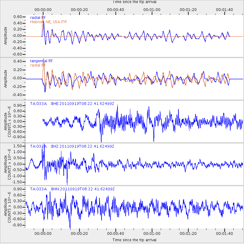
O33A Hebron, NE, USA - Earthquake Result Viewer
*The percent match for this event was below the threshold and hence no stack was calculated.
| Earthquake location: |
Fox Islands, Aleutian Islands |
| Earthquake latitude/longitude: |
52.0/-172.0 |
| Earthquake time(UTC): |
2011/09/19 (262) 08:14:14 GMT |
| Earthquake Depth: |
31 km |
| Earthquake Magnitude: |
5.5 MB, 5.1 MS, 5.7 MW, 5.6 MW |
| Earthquake Catalog/Contributor: |
WHDF/NEIC |
|
| Network: |
TA USArray Transportable Network (new EarthScope stations) |
| Station: |
O33A Hebron, NE, USA |
| Lat/Lon: |
40.08 N/97.58 W |
| Elevation: |
480 m |
|
| Distance: |
50.8 deg |
| Az: |
72.443 deg |
| Baz: |
309.867 deg |
| Ray Param: |
$rayparam |
*The percent match for this event was below the threshold and hence was not used in the summary stack. |
|
| Radial Match: |
65.88766 % |
| Radial Bump: |
400 |
| Transverse Match: |
79.86951 % |
| Transverse Bump: |
400 |
| SOD ConfigId: |
414626 |
| Insert Time: |
2012-01-27 13:47:26.475 +0000 |
| GWidth: |
2.5 |
| Max Bumps: |
400 |
| Tol: |
0.001 |
|
Signal To Noise
| Channel | StoN | STA | LTA |
| TA:O33A: :BHZ:20110919T08:22:41.62499Z | 3.2818468 | 6.2200354E-7 | 1.895285E-7 |
| TA:O33A: :BHN:20110919T08:22:41.62499Z | 2.1487217 | 3.4045237E-7 | 1.5844414E-7 |
| TA:O33A: :BHE:20110919T08:22:41.62499Z | 2.530508 | 4.5478097E-7 | 1.7971924E-7 |
| Arrivals |
| Ps | |
| PpPs | |
| PsPs/PpSs | |


