You are here: Home > Network List > TA - USArray Transportable Network (new EarthScope stations) Stations List
> Station Z40A Long Farm, Magnolia, AR, USA > Earthquake Result Viewer
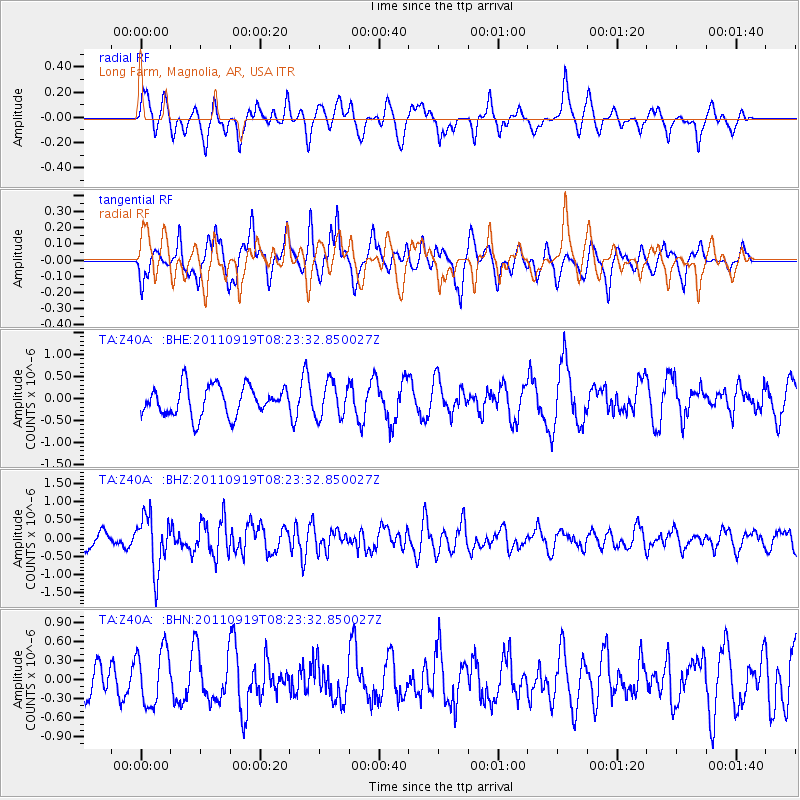
Z40A Long Farm, Magnolia, AR, USA - Earthquake Result Viewer
*The percent match for this event was below the threshold and hence no stack was calculated.
| Earthquake location: |
Fox Islands, Aleutian Islands |
| Earthquake latitude/longitude: |
52.0/-172.0 |
| Earthquake time(UTC): |
2011/09/19 (262) 08:14:14 GMT |
| Earthquake Depth: |
31 km |
| Earthquake Magnitude: |
5.5 MB, 5.1 MS, 5.7 MW, 5.6 MW |
| Earthquake Catalog/Contributor: |
WHDF/NEIC |
|
| Network: |
TA USArray Transportable Network (new EarthScope stations) |
| Station: |
Z40A Long Farm, Magnolia, AR, USA |
| Lat/Lon: |
33.26 N/93.40 W |
| Elevation: |
78 m |
|
| Distance: |
57.9 deg |
| Az: |
75.871 deg |
| Baz: |
314.362 deg |
| Ray Param: |
$rayparam |
*The percent match for this event was below the threshold and hence was not used in the summary stack. |
|
| Radial Match: |
55.847027 % |
| Radial Bump: |
400 |
| Transverse Match: |
58.745132 % |
| Transverse Bump: |
395 |
| SOD ConfigId: |
414626 |
| Insert Time: |
2012-01-27 14:00:52.708 +0000 |
| GWidth: |
2.5 |
| Max Bumps: |
400 |
| Tol: |
0.001 |
|
Signal To Noise
| Channel | StoN | STA | LTA |
| TA:Z40A: :BHZ:20110919T08:23:32.850027Z | 3.6249208 | 7.452136E-7 | 2.0558063E-7 |
| TA:Z40A: :BHN:20110919T08:23:32.850027Z | 1.8621793 | 4.455751E-7 | 2.3927615E-7 |
| TA:Z40A: :BHE:20110919T08:23:32.850027Z | 1.1959826 | 3.990967E-7 | 3.3369778E-7 |
| Arrivals |
| Ps | |
| PpPs | |
| PsPs/PpSs | |


