You are here: Home > Network List > TA - USArray Transportable Network (new EarthScope stations) Stations List
> Station L40A Anamosa, IA, USA > Earthquake Result Viewer
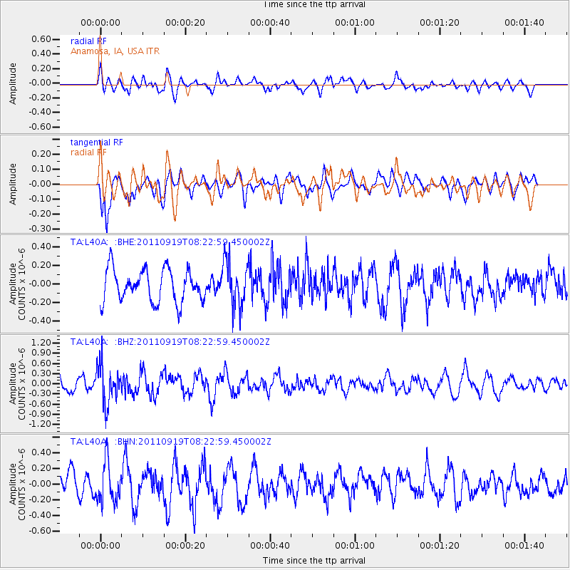
L40A Anamosa, IA, USA - Earthquake Result Viewer
*The percent match for this event was below the threshold and hence no stack was calculated.
| Earthquake location: |
Fox Islands, Aleutian Islands |
| Earthquake latitude/longitude: |
52.0/-172.0 |
| Earthquake time(UTC): |
2011/09/19 (262) 08:14:14 GMT |
| Earthquake Depth: |
31 km |
| Earthquake Magnitude: |
5.5 MB, 5.1 MS, 5.7 MW, 5.6 MW |
| Earthquake Catalog/Contributor: |
WHDF/NEIC |
|
| Network: |
TA USArray Transportable Network (new EarthScope stations) |
| Station: |
L40A Anamosa, IA, USA |
| Lat/Lon: |
42.06 N/91.22 W |
| Elevation: |
242 m |
|
| Distance: |
53.2 deg |
| Az: |
66.585 deg |
| Baz: |
310.426 deg |
| Ray Param: |
$rayparam |
*The percent match for this event was below the threshold and hence was not used in the summary stack. |
|
| Radial Match: |
50.10056 % |
| Radial Bump: |
400 |
| Transverse Match: |
69.599884 % |
| Transverse Bump: |
400 |
| SOD ConfigId: |
414626 |
| Insert Time: |
2012-01-27 14:07:35.244 +0000 |
| GWidth: |
2.5 |
| Max Bumps: |
400 |
| Tol: |
0.001 |
|
Signal To Noise
| Channel | StoN | STA | LTA |
| TA:L40A: :BHZ:20110919T08:22:59.450002Z | 2.4986546 | 5.720149E-7 | 2.2892917E-7 |
| TA:L40A: :BHN:20110919T08:22:59.450002Z | 2.1674025 | 2.547915E-7 | 1.17556155E-7 |
| TA:L40A: :BHE:20110919T08:22:59.450002Z | 1.4337239 | 2.5062593E-7 | 1.7480767E-7 |
| Arrivals |
| Ps | |
| PpPs | |
| PsPs/PpSs | |


