You are here: Home > Network List > CI - Caltech Regional Seismic Network Stations List
> Station MPM Manuel Prospect Mine, California, USA > Earthquake Result Viewer
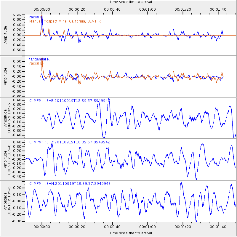
MPM Manuel Prospect Mine, California, USA - Earthquake Result Viewer
*The percent match for this event was below the threshold and hence no stack was calculated.
| Earthquake location: |
Guatemala |
| Earthquake latitude/longitude: |
14.2/-90.2 |
| Earthquake time(UTC): |
2011/09/19 (262) 18:33:55 GMT |
| Earthquake Depth: |
9.0 km |
| Earthquake Magnitude: |
5.6 MW, 5.3 MS, 5.1 MB, 5.6 MW |
| Earthquake Catalog/Contributor: |
WHDF/NEIC |
|
| Network: |
CI Caltech Regional Seismic Network |
| Station: |
MPM Manuel Prospect Mine, California, USA |
| Lat/Lon: |
36.06 N/117.49 W |
| Elevation: |
185 m |
|
| Distance: |
32.7 deg |
| Az: |
316.644 deg |
| Baz: |
124.739 deg |
| Ray Param: |
$rayparam |
*The percent match for this event was below the threshold and hence was not used in the summary stack. |
|
| Radial Match: |
68.02781 % |
| Radial Bump: |
367 |
| Transverse Match: |
58.078854 % |
| Transverse Bump: |
369 |
| SOD ConfigId: |
414626 |
| Insert Time: |
2012-01-27 14:18:47.008 +0000 |
| GWidth: |
2.5 |
| Max Bumps: |
400 |
| Tol: |
0.001 |
|
Signal To Noise
| Channel | StoN | STA | LTA |
| CI:MPM: :BHZ:20110919T18:39:57.894994Z | 1.3545345 | 2.1301548E-7 | 1.5726101E-7 |
| CI:MPM: :BHN:20110919T18:39:57.894994Z | 0.82352835 | 9.575351E-8 | 1.1627226E-7 |
| CI:MPM: :BHE:20110919T18:39:57.894994Z | 1.7815129 | 2.3927748E-7 | 1.3431139E-7 |
| Arrivals |
| Ps | |
| PpPs | |
| PsPs/PpSs | |


