You are here: Home > Network List > US - United States National Seismic Network Stations List
> Station MSO Missoula, Montana, USA > Earthquake Result Viewer
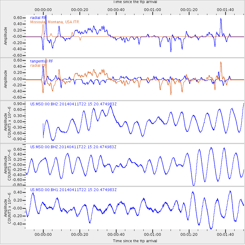
MSO Missoula, Montana, USA - Earthquake Result Viewer
*The percent match for this event was below the threshold and hence no stack was calculated.
| Earthquake location: |
Solomon Islands |
| Earthquake latitude/longitude: |
-6.8/155.0 |
| Earthquake time(UTC): |
2014/04/11 (101) 22:02:30 GMT |
| Earthquake Depth: |
35 km |
| Earthquake Magnitude: |
4.8 mb |
| Earthquake Catalog/Contributor: |
ISC/ISC |
|
| Network: |
US United States National Seismic Network |
| Station: |
MSO Missoula, Montana, USA |
| Lat/Lon: |
46.83 N/113.94 W |
| Elevation: |
1264 m |
|
| Distance: |
95.6 deg |
| Az: |
43.613 deg |
| Baz: |
266.138 deg |
| Ray Param: |
$rayparam |
*The percent match for this event was below the threshold and hence was not used in the summary stack. |
|
| Radial Match: |
48.358795 % |
| Radial Bump: |
400 |
| Transverse Match: |
64.9515 % |
| Transverse Bump: |
400 |
| SOD ConfigId: |
3390531 |
| Insert Time: |
2019-04-11 07:45:36.602 +0000 |
| GWidth: |
2.5 |
| Max Bumps: |
400 |
| Tol: |
0.001 |
|
Signal To Noise
| Channel | StoN | STA | LTA |
| US:MSO:00:BHZ:20140411T22:15:20.474983Z | 1.0409056 | 2.4535564E-7 | 2.3571364E-7 |
| US:MSO:00:BH1:20140411T22:15:20.474983Z | 0.5394131 | 1.5206496E-7 | 2.8190817E-7 |
| US:MSO:00:BH2:20140411T22:15:20.474983Z | 1.8397105 | 6.5222025E-7 | 3.545233E-7 |
| Arrivals |
| Ps | |
| PpPs | |
| PsPs/PpSs | |


