You are here: Home > Network List > TA - USArray Transportable Network (new EarthScope stations) Stations List
> Station G34A Benson, MN, USA > Earthquake Result Viewer
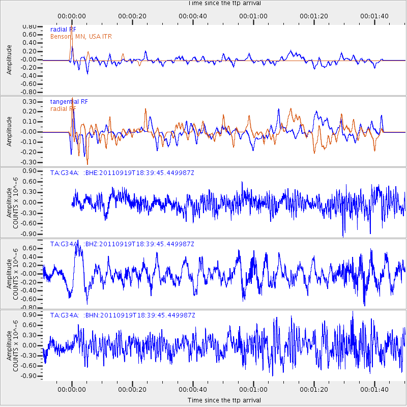
G34A Benson, MN, USA - Earthquake Result Viewer
*The percent match for this event was below the threshold and hence no stack was calculated.
| Earthquake location: |
Guatemala |
| Earthquake latitude/longitude: |
14.2/-90.2 |
| Earthquake time(UTC): |
2011/09/19 (262) 18:33:55 GMT |
| Earthquake Depth: |
9.0 km |
| Earthquake Magnitude: |
5.6 MW, 5.3 MS, 5.1 MB, 5.6 MW |
| Earthquake Catalog/Contributor: |
WHDF/NEIC |
|
| Network: |
TA USArray Transportable Network (new EarthScope stations) |
| Station: |
G34A Benson, MN, USA |
| Lat/Lon: |
45.24 N/95.64 W |
| Elevation: |
316 m |
|
| Distance: |
31.3 deg |
| Az: |
352.645 deg |
| Baz: |
169.879 deg |
| Ray Param: |
$rayparam |
*The percent match for this event was below the threshold and hence was not used in the summary stack. |
|
| Radial Match: |
50.709606 % |
| Radial Bump: |
400 |
| Transverse Match: |
55.33237 % |
| Transverse Bump: |
400 |
| SOD ConfigId: |
414626 |
| Insert Time: |
2012-01-27 14:24:45.385 +0000 |
| GWidth: |
2.5 |
| Max Bumps: |
400 |
| Tol: |
0.001 |
|
Signal To Noise
| Channel | StoN | STA | LTA |
| TA:G34A: :BHZ:20110919T18:39:45.449987Z | 3.0012436 | 4.677047E-7 | 1.5583697E-7 |
| TA:G34A: :BHN:20110919T18:39:45.449987Z | 1.4186358 | 2.736023E-7 | 1.9286294E-7 |
| TA:G34A: :BHE:20110919T18:39:45.449987Z | 0.79486793 | 1.3590926E-7 | 1.7098344E-7 |
| Arrivals |
| Ps | |
| PpPs | |
| PsPs/PpSs | |


