You are here: Home > Network List > AZ - ANZA Regional Network Stations List
> Station SMER AZ.SMER > Earthquake Result Viewer
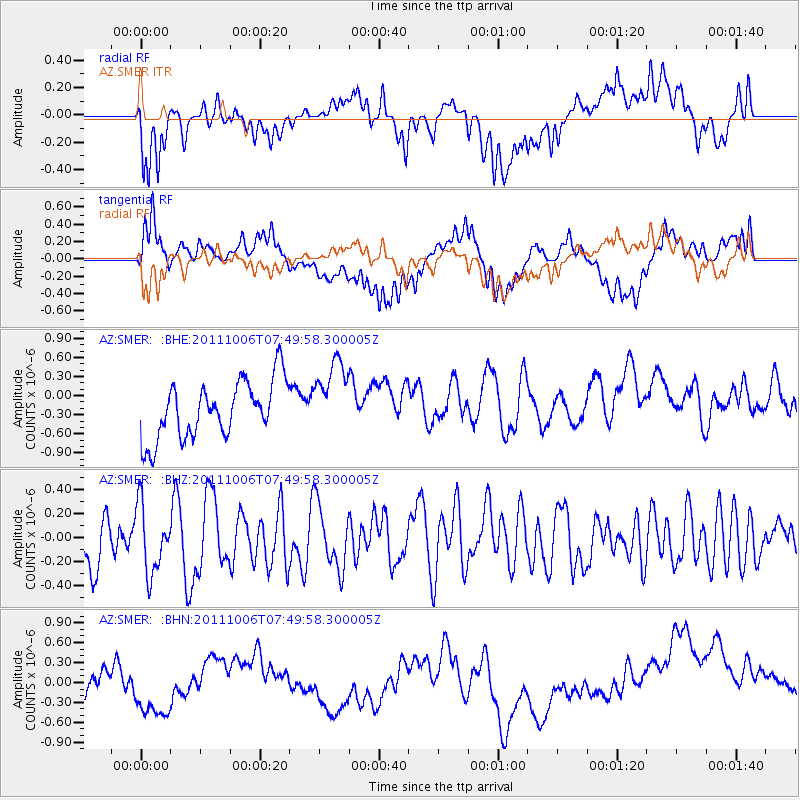
SMER AZ.SMER - Earthquake Result Viewer
*The percent match for this event was below the threshold and hence no stack was calculated.
| Earthquake location: |
W. Caroline Islands, Micronesia |
| Earthquake latitude/longitude: |
9.7/138.2 |
| Earthquake time(UTC): |
2011/10/06 (279) 07:37:01 GMT |
| Earthquake Depth: |
20 km |
| Earthquake Magnitude: |
5.6 MB, 5.5 MS, 5.9 MW, 5.8 MW |
| Earthquake Catalog/Contributor: |
WHDF/NEIC |
|
| Network: |
AZ ANZA Regional Network |
| Station: |
SMER AZ.SMER |
| Lat/Lon: |
33.46 N/117.17 W |
| Elevation: |
355 m |
|
| Distance: |
96.6 deg |
| Az: |
54.54 deg |
| Baz: |
286.143 deg |
| Ray Param: |
$rayparam |
*The percent match for this event was below the threshold and hence was not used in the summary stack. |
|
| Radial Match: |
58.91911 % |
| Radial Bump: |
400 |
| Transverse Match: |
39.732285 % |
| Transverse Bump: |
400 |
| SOD ConfigId: |
424168 |
| Insert Time: |
2012-02-04 04:52:59.202 +0000 |
| GWidth: |
2.5 |
| Max Bumps: |
400 |
| Tol: |
0.001 |
|
Signal To Noise
| Channel | StoN | STA | LTA |
| AZ:SMER: :BHZ:20111006T07:49:58.300005Z | 1.0889381 | 2.946682E-7 | 2.7060142E-7 |
| AZ:SMER: :BHN:20111006T07:49:58.300005Z | 0.9911296 | 6.6708003E-7 | 6.730503E-7 |
| AZ:SMER: :BHE:20111006T07:49:58.300005Z | 1.3033867 | 5.826426E-7 | 4.4702205E-7 |
| Arrivals |
| Ps | |
| PpPs | |
| PsPs/PpSs | |


