You are here: Home > Network List > KN - Kyrgyz Seismic Telemetry Network Stations List
> Station ULHL - > Earthquake Result Viewer
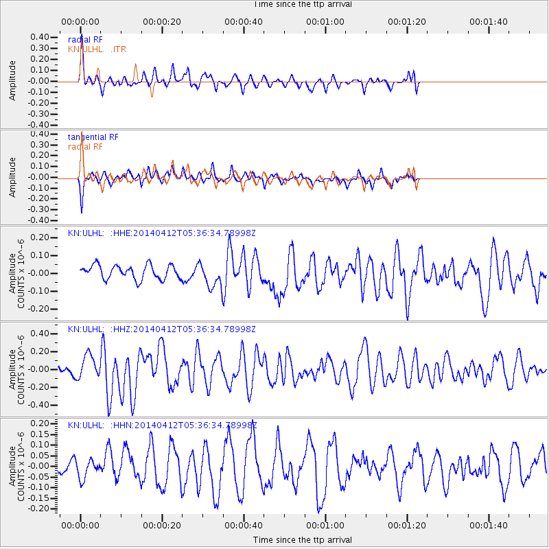
ULHL - - Earthquake Result Viewer
*The percent match for this event was below the threshold and hence no stack was calculated.
| Earthquake location: |
Solomon Islands |
| Earthquake latitude/longitude: |
-7.1/155.2 |
| Earthquake time(UTC): |
2014/04/12 (102) 05:24:25 GMT |
| Earthquake Depth: |
35 km |
| Earthquake Magnitude: |
6.1 MWW, 6.2 MWC |
| Earthquake Catalog/Contributor: |
NEIC PDE/NEIC COMCAT |
|
| Network: |
KN Kyrgyz Seismic Telemetry Network |
| Station: |
ULHL - |
| Lat/Lon: |
42.25 N/76.24 E |
| Elevation: |
2040 m |
|
| Distance: |
86.7 deg |
| Az: |
313.106 deg |
| Baz: |
102.63 deg |
| Ray Param: |
$rayparam |
*The percent match for this event was below the threshold and hence was not used in the summary stack. |
|
| Radial Match: |
66.14835 % |
| Radial Bump: |
400 |
| Transverse Match: |
53.696186 % |
| Transverse Bump: |
378 |
| SOD ConfigId: |
3390531 |
| Insert Time: |
2019-04-11 07:52:45.856 +0000 |
| GWidth: |
2.5 |
| Max Bumps: |
400 |
| Tol: |
0.001 |
|
Signal To Noise
| Channel | StoN | STA | LTA |
| KN:ULHL: :HHZ:20140412T05:36:34.78998Z | 2.386041 | 1.3458005E-7 | 5.6403074E-8 |
| KN:ULHL: :HHN:20140412T05:36:34.78998Z | 1.0810531 | 4.1033232E-8 | 3.795672E-8 |
| KN:ULHL: :HHE:20140412T05:36:34.78998Z | 1.678431 | 6.452799E-8 | 3.844542E-8 |
| Arrivals |
| Ps | |
| PpPs | |
| PsPs/PpSs | |


