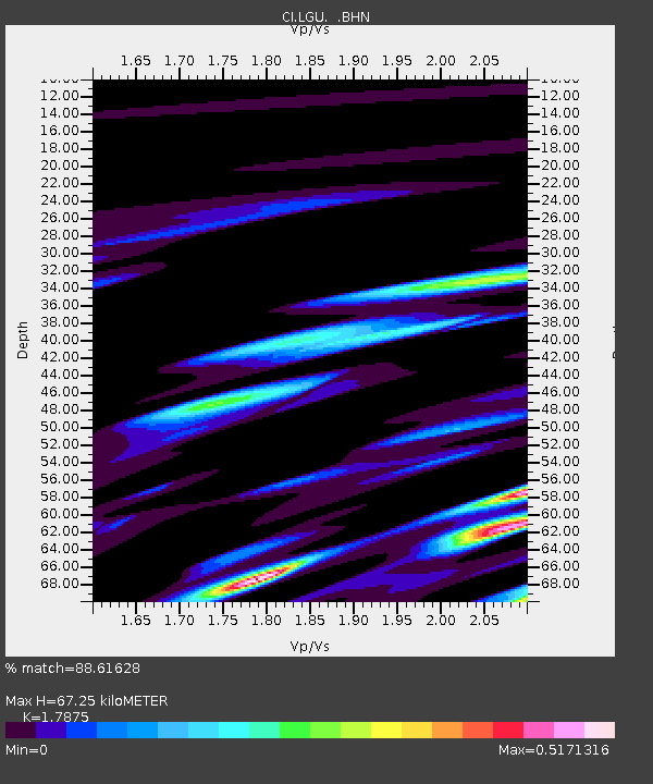
LGU Laguna Peak, California, USA - Earthquake Result Viewer
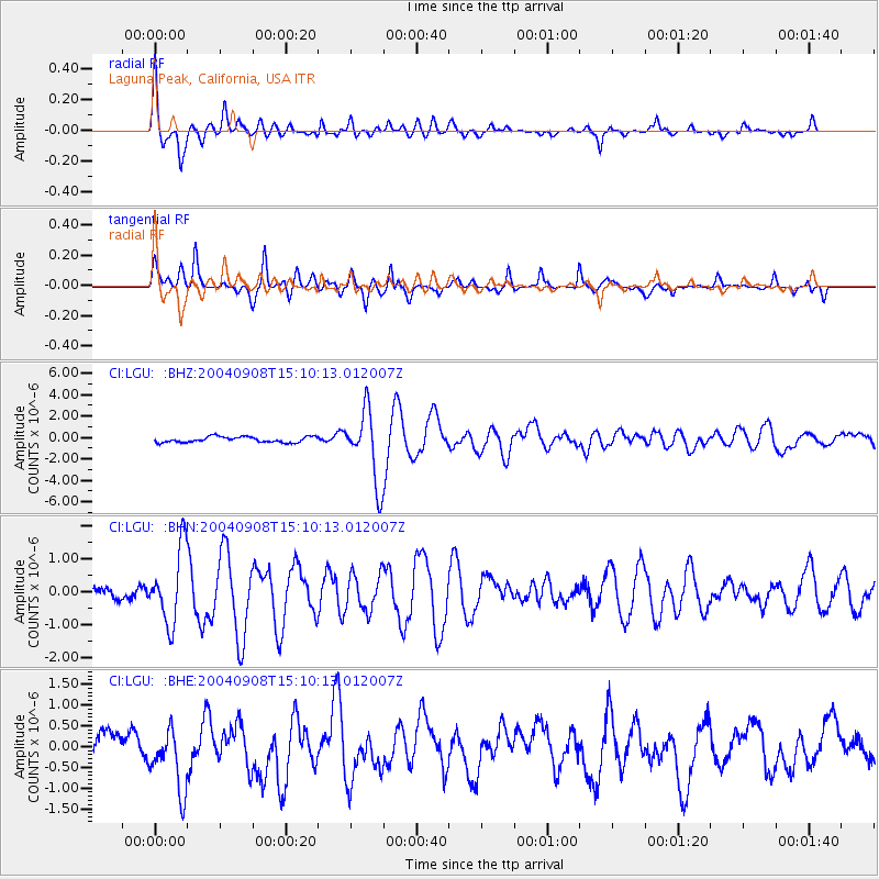
Earthquake location: Near S. Coast Of Honshu, Japan
Earthquake latitude/longitude: 33.1/137.2
Earthquake time(UTC): 2004/09/08 (252) 14:58:25 GMT
Earthquake Depth: 21 km
Earthquake Magnitude: 6.2 MB, 5.8 MS, 6.2 MW, 6.1 MW
Earthquake Catalog/Contributor: WHDF/NEIC
Network: CI Caltech Regional Seismic Network
Station: LGU Laguna Peak, California, USA
Lat/Lon: 34.11 N/119.07 W
Elevation: 381 m
Distance: 82.0 deg
Az: 54.472 deg
Baz: 304.619 deg
Ray Param: 0.04714112
Estimated Moho Depth: 67.25 km
Estimated Crust Vp/Vs: 1.79
Assumed Crust Vp: 6.1 km/s
Estimated Crust Vs: 3.413 km/s
Estimated Crust Poisson's Ratio: 0.27
Radial Match: 88.61628 %
Radial Bump: 400
Transverse Match: 86.219864 %
Transverse Bump: 400
SOD ConfigId: 2459
Insert Time: 2010-02-25 20:18:42.791 +0000
GWidth: 2.5
Max Bumps: 400
Tol: 0.001

Signal To Noise

ChannelStoNSTALTA
CI:LGU: :BHN:20040908T15:10:13.012007Z5.04144671.1258874E-62.2332625E-7
CI:LGU: :BHE:20040908T15:10:13.012007Z1.9756597.3508755E-73.720721E-7
CI:LGU: :BHZ:20040908T15:10:13.012007Z12.8333213.3344252E-62.598256E-7
Arrivals
Ps8.9 SECOND
PpPs30 SECOND
PsPs/PpSs39 SECOND