You are here: Home > Network List > UW - Pacific Northwest Regional Seismic Network Stations List
> Station UMAT Pilot Rock, OR, USA > Earthquake Result Viewer
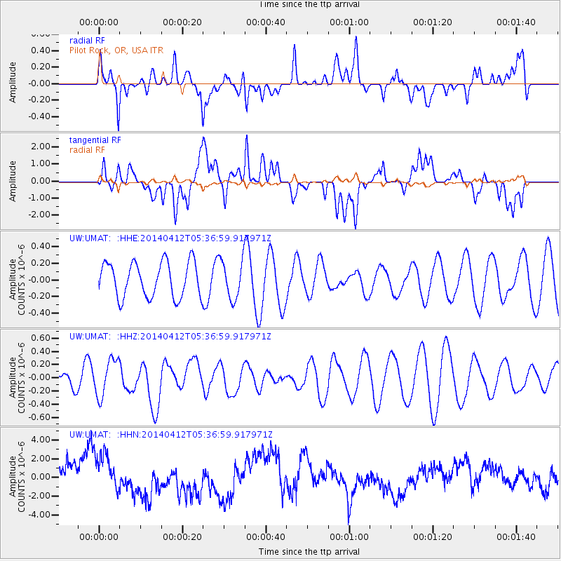
UMAT Pilot Rock, OR, USA - Earthquake Result Viewer
*The percent match for this event was below the threshold and hence no stack was calculated.
| Earthquake location: |
Solomon Islands |
| Earthquake latitude/longitude: |
-7.1/155.2 |
| Earthquake time(UTC): |
2014/04/12 (102) 05:24:25 GMT |
| Earthquake Depth: |
35 km |
| Earthquake Magnitude: |
6.1 MWW, 6.2 MWC |
| Earthquake Catalog/Contributor: |
NEIC PDE/NEIC COMCAT |
|
| Network: |
UW Pacific Northwest Regional Seismic Network |
| Station: |
UMAT Pilot Rock, OR, USA |
| Lat/Lon: |
45.29 N/118.96 W |
| Elevation: |
1318 m |
|
| Distance: |
92.1 deg |
| Az: |
44.786 deg |
| Baz: |
262.046 deg |
| Ray Param: |
$rayparam |
*The percent match for this event was below the threshold and hence was not used in the summary stack. |
|
| Radial Match: |
65.745 % |
| Radial Bump: |
400 |
| Transverse Match: |
36.730263 % |
| Transverse Bump: |
400 |
| SOD ConfigId: |
3390531 |
| Insert Time: |
2019-04-11 07:54:06.296 +0000 |
| GWidth: |
2.5 |
| Max Bumps: |
400 |
| Tol: |
0.001 |
|
Signal To Noise
| Channel | StoN | STA | LTA |
| UW:UMAT: :HHZ:20140412T05:36:59.917971Z | 1.921447 | 2.9105468E-7 | 1.5147681E-7 |
| UW:UMAT: :HHN:20140412T05:36:59.917971Z | 1.5358442 | 2.1064784E-6 | 1.3715443E-6 |
| UW:UMAT: :HHE:20140412T05:36:59.917971Z | 1.0934557 | 2.2870016E-7 | 2.0915358E-7 |
| Arrivals |
| Ps | |
| PpPs | |
| PsPs/PpSs | |


