Y12C Blythe, CA, USA - Earthquake Result Viewer
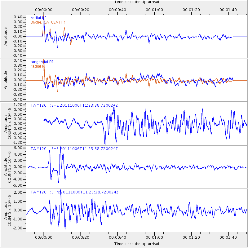
Earthquake location: Salta Province, Argentina
Earthquake latitude/longitude: -24.2/-64.2
Earthquake time(UTC): 2011/10/06 (279) 11:12:30 GMT
Earthquake Depth: 15 km
Earthquake Magnitude: 6.5 MB, 5.7 MS, 6.1 MW, 5.9 MW
Earthquake Catalog/Contributor: WHDF/NEIC
Network: TA USArray Transportable Network (new EarthScope stations)
Station: Y12C Blythe, CA, USA
Lat/Lon: 33.75 N/114.52 W
Elevation: 196 m
Distance: 74.9 deg
Az: 318.388 deg
Baz: 133.287 deg
Ray Param: 0.05202475
Estimated Moho Depth: 55.0 km
Estimated Crust Vp/Vs: 1.71
Assumed Crust Vp: 6.155 km/s
Estimated Crust Vs: 3.61 km/s
Estimated Crust Poisson's Ratio: 0.24
Radial Match: 87.28406 %
Radial Bump: 400
Transverse Match: 69.98401 %
Transverse Bump: 400
SOD ConfigId: 424168
Insert Time: 2012-02-04 05:28:19.958 +0000
GWidth: 2.5
Max Bumps: 400
Tol: 0.001

Signal To Noise

ChannelStoNSTALTA
TA:Y12C: :BHZ:20111006T11:23:38.720024Z9.8699422.018085E-62.0446777E-7
TA:Y12C: :BHN:20111006T11:23:38.720024Z2.8933047.2105394E-72.492147E-7
TA:Y12C: :BHE:20111006T11:23:38.720024Z2.6641214.8212195E-71.8096851E-7
Arrivals
Ps6.5 SECOND
PpPs23 SECOND
PsPs/PpSs30 SECOND