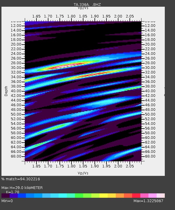
336A Riesel, TX, USA - Earthquake Result Viewer

Earthquake location: Salta Province, Argentina
Earthquake latitude/longitude: -24.2/-64.2
Earthquake time(UTC): 2011/10/06 (279) 11:12:30 GMT
Earthquake Depth: 15 km
Earthquake Magnitude: 6.5 MB, 5.7 MS, 6.1 MW, 5.9 MW
Earthquake Catalog/Contributor: WHDF/NEIC
Network: TA USArray Transportable Network (new EarthScope stations)
Station: 336A Riesel, TX, USA
Lat/Lon: 31.39 N/96.84 W
Elevation: 140 m
Distance: 63.5 deg
Az: 328.978 deg
Baz: 146.607 deg
Ray Param: 0.059548795
Estimated Moho Depth: 29.0 km
Estimated Crust Vp/Vs: 1.78
Assumed Crust Vp: 6.347 km/s
Estimated Crust Vs: 3.566 km/s
Estimated Crust Poisson's Ratio: 0.27
Radial Match: 94.302216 %
Radial Bump: 340
Transverse Match: 81.39116 %
Transverse Bump: 400
SOD ConfigId: 424168
Insert Time: 2012-02-04 05:34:01.687 +0000
GWidth: 2.5
Max Bumps: 400
Tol: 0.001

Signal To Noise

ChannelStoNSTALTA
TA:336A: :BHZ:20111006T11:22:28.100029Z38.4349983.47884E-69.0512295E-8
TA:336A: :BHN:20111006T11:22:28.100029Z9.3850981.5800845E-61.68361E-7
TA:336A: :BHE:20111006T11:22:28.100029Z4.7277371.0556541E-62.2328953E-7
Arrivals
Ps3.7 SECOND
PpPs12 SECOND
PsPs/PpSs16 SECOND