Y38A Idabel, OK, USA - Earthquake Result Viewer
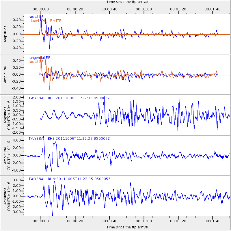
Earthquake location: Salta Province, Argentina
Earthquake latitude/longitude: -24.2/-64.2
Earthquake time(UTC): 2011/10/06 (279) 11:12:30 GMT
Earthquake Depth: 15 km
Earthquake Magnitude: 6.5 MB, 5.7 MS, 6.1 MW, 5.9 MW
Earthquake Catalog/Contributor: WHDF/NEIC
Network: TA USArray Transportable Network (new EarthScope stations)
Station: Y38A Idabel, OK, USA
Lat/Lon: 33.93 N/94.73 W
Elevation: 118 m
Distance: 64.7 deg
Az: 332.155 deg
Baz: 149.132 deg
Ray Param: 0.058767773
Estimated Moho Depth: 30.75 km
Estimated Crust Vp/Vs: 1.60
Assumed Crust Vp: 6.245 km/s
Estimated Crust Vs: 3.903 km/s
Estimated Crust Poisson's Ratio: 0.18
Radial Match: 87.04023 %
Radial Bump: 400
Transverse Match: 73.59438 %
Transverse Bump: 400
SOD ConfigId: 424168
Insert Time: 2012-02-04 05:37:35.191 +0000
GWidth: 2.5
Max Bumps: 400
Tol: 0.001

Signal To Noise

ChannelStoNSTALTA
TA:Y38A: :BHZ:20111006T11:22:35.950005Z8.4553932.361891E-62.7933547E-7
TA:Y38A: :BHN:20111006T11:22:35.950005Z5.7448141.140697E-61.9856117E-7
TA:Y38A: :BHE:20111006T11:22:35.950005Z2.2141645.84179E-72.6383728E-7
Arrivals
Ps3.1 SECOND
PpPs12 SECOND
PsPs/PpSs15 SECOND