You are here: Home > Network List > TA - USArray Transportable Network (new EarthScope stations) Stations List
> Station N35A Tabor, IA, USA > Earthquake Result Viewer
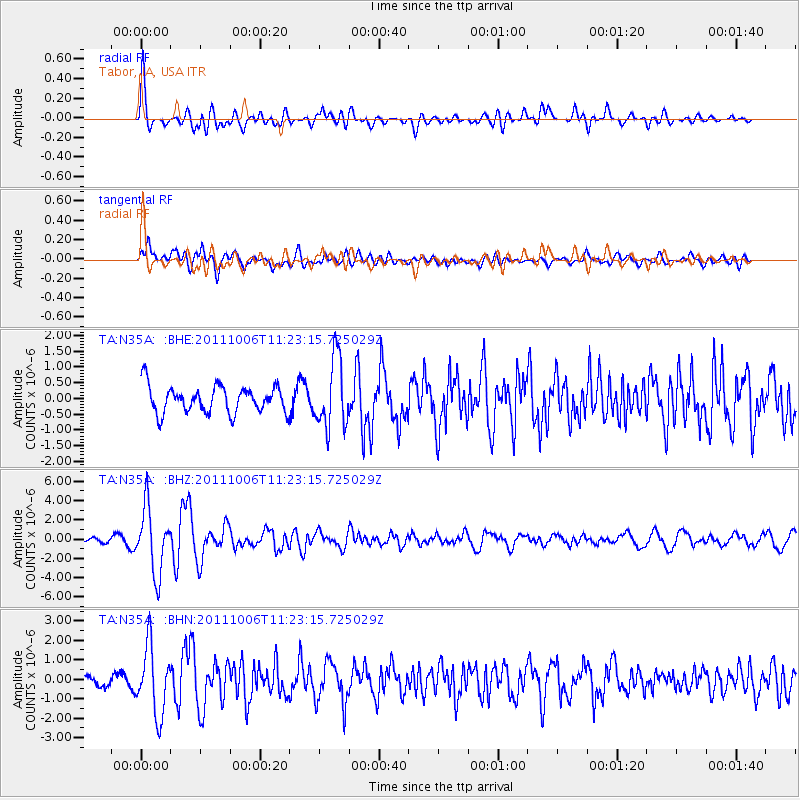
N35A Tabor, IA, USA - Earthquake Result Viewer
*The percent match for this event was below the threshold and hence no stack was calculated.
| Earthquake location: |
Salta Province, Argentina |
| Earthquake latitude/longitude: |
-24.2/-64.2 |
| Earthquake time(UTC): |
2011/10/06 (279) 11:12:30 GMT |
| Earthquake Depth: |
15 km |
| Earthquake Magnitude: |
6.5 MB, 5.7 MS, 6.1 MW, 5.9 MW |
| Earthquake Catalog/Contributor: |
WHDF/NEIC |
|
| Network: |
TA USArray Transportable Network (new EarthScope stations) |
| Station: |
N35A Tabor, IA, USA |
| Lat/Lon: |
40.86 N/95.64 W |
| Elevation: |
353 m |
|
| Distance: |
71.0 deg |
| Az: |
335.277 deg |
| Baz: |
149.761 deg |
| Ray Param: |
$rayparam |
*The percent match for this event was below the threshold and hence was not used in the summary stack. |
|
| Radial Match: |
78.236824 % |
| Radial Bump: |
400 |
| Transverse Match: |
75.2578 % |
| Transverse Bump: |
400 |
| SOD ConfigId: |
424168 |
| Insert Time: |
2012-02-04 05:38:28.657 +0000 |
| GWidth: |
2.5 |
| Max Bumps: |
400 |
| Tol: |
0.001 |
|
Signal To Noise
| Channel | StoN | STA | LTA |
| TA:N35A: :BHZ:20111006T11:23:15.725029Z | 11.091475 | 3.3582282E-6 | 3.0277562E-7 |
| TA:N35A: :BHN:20111006T11:23:15.725029Z | 5.424338 | 1.7382497E-6 | 3.204538E-7 |
| TA:N35A: :BHE:20111006T11:23:15.725029Z | 2.5937269 | 1.0949125E-6 | 4.221387E-7 |
| Arrivals |
| Ps | |
| PpPs | |
| PsPs/PpSs | |


