
O33A Hebron, NE, USA - Earthquake Result Viewer
| ||||||||||||||||||
| ||||||||||||||||||
| ||||||||||||||||||
|
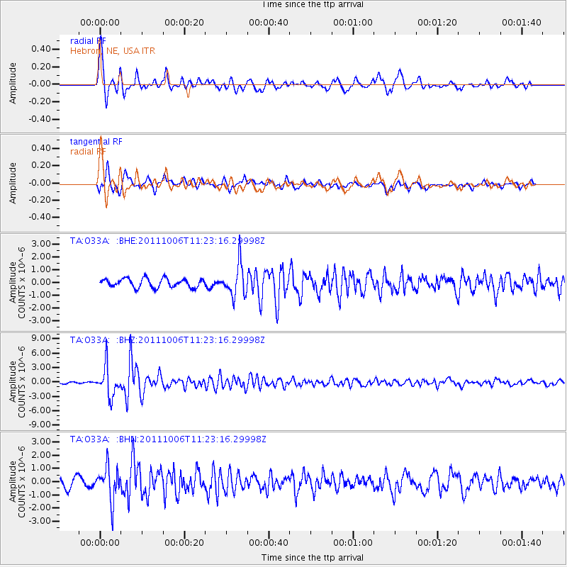
Signal To Noise
| Channel | StoN | STA | LTA |
| TA:O33A: :BHZ:20111006T11:23:16.29998Z | 10.84751 | 3.1810468E-6 | 2.9325133E-7 |
| TA:O33A: :BHN:20111006T11:23:16.29998Z | 3.2657857 | 1.2774918E-6 | 3.911744E-7 |
| TA:O33A: :BHE:20111006T11:23:16.29998Z | 3.65032 | 1.2727531E-6 | 3.4866892E-7 |
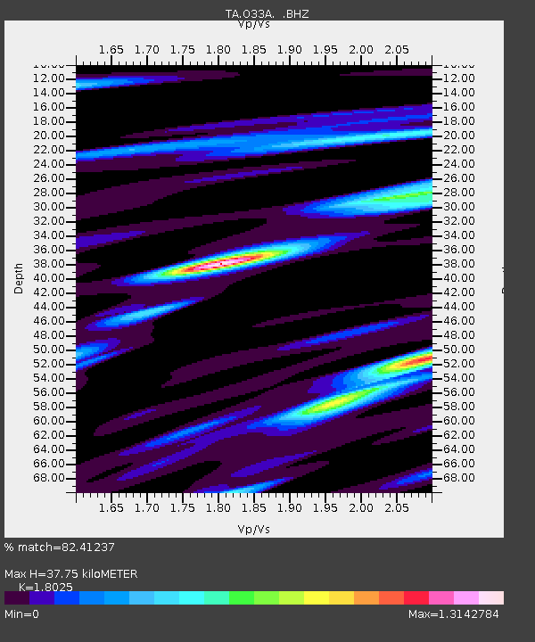
| Arrivals | |
| Ps | 4.8 SECOND |
| PpPs | 16 SECOND |
| PsPs/PpSs | 21 SECOND |

