O34A Beatrice, NE, USA - Earthquake Result Viewer
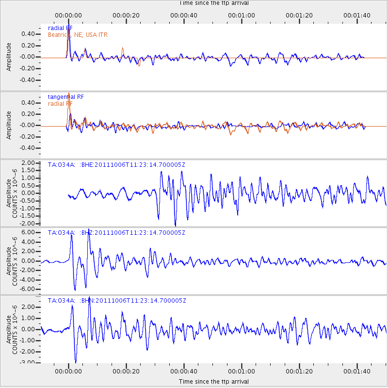
Earthquake location: Salta Province, Argentina
Earthquake latitude/longitude: -24.2/-64.2
Earthquake time(UTC): 2011/10/06 (279) 11:12:30 GMT
Earthquake Depth: 15 km
Earthquake Magnitude: 6.5 MB, 5.7 MS, 6.1 MW, 5.9 MW
Earthquake Catalog/Contributor: WHDF/NEIC
Network: TA USArray Transportable Network (new EarthScope stations)
Station: O34A Beatrice, NE, USA
Lat/Lon: 40.18 N/96.69 W
Elevation: 409 m
Distance: 70.8 deg
Az: 334.182 deg
Baz: 148.722 deg
Ray Param: 0.054718986
Estimated Moho Depth: 49.25 km
Estimated Crust Vp/Vs: 1.62
Assumed Crust Vp: 6.498 km/s
Estimated Crust Vs: 4.023 km/s
Estimated Crust Poisson's Ratio: 0.19
Radial Match: 88.84037 %
Radial Bump: 400
Transverse Match: 70.351036 %
Transverse Bump: 400
SOD ConfigId: 424168
Insert Time: 2012-02-04 05:40:52.525 +0000
GWidth: 2.5
Max Bumps: 400
Tol: 0.001

Signal To Noise

ChannelStoNSTALTA
TA:O34A: :BHZ:20111006T11:23:14.700005Z12.6670352.7976673E-62.2086205E-7
TA:O34A: :BHN:20111006T11:23:14.700005Z4.43113371.2240807E-62.762455E-7
TA:O34A: :BHE:20111006T11:23:14.700005Z3.8352097.5683465E-71.9733858E-7
Arrivals
Ps4.9 SECOND
PpPs19 SECOND
PsPs/PpSs24 SECOND