U36A Oologah, OK, USA - Earthquake Result Viewer
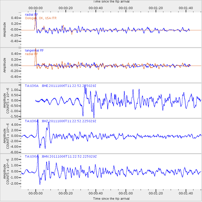
Earthquake location: Salta Province, Argentina
Earthquake latitude/longitude: -24.2/-64.2
Earthquake time(UTC): 2011/10/06 (279) 11:12:30 GMT
Earthquake Depth: 15 km
Earthquake Magnitude: 6.5 MB, 5.7 MS, 6.1 MW, 5.9 MW
Earthquake Catalog/Contributor: WHDF/NEIC
Network: TA USArray Transportable Network (new EarthScope stations)
Station: U36A Oologah, OK, USA
Lat/Lon: 36.39 N/95.73 W
Elevation: 187 m
Distance: 67.2 deg
Az: 332.773 deg
Baz: 148.81 deg
Ray Param: 0.057105932
Estimated Moho Depth: 33.0 km
Estimated Crust Vp/Vs: 1.90
Assumed Crust Vp: 6.53 km/s
Estimated Crust Vs: 3.442 km/s
Estimated Crust Poisson's Ratio: 0.31
Radial Match: 80.94567 %
Radial Bump: 400
Transverse Match: 71.07781 %
Transverse Bump: 400
SOD ConfigId: 424168
Insert Time: 2012-02-04 05:42:06.408 +0000
GWidth: 2.5
Max Bumps: 400
Tol: 0.001

Signal To Noise

ChannelStoNSTALTA
TA:U36A: :BHZ:20111006T11:22:52.225029Z12.6161242.445289E-61.9382253E-7
TA:U36A: :BHN:20111006T11:22:52.225029Z5.48780441.1485583E-62.0929288E-7
TA:U36A: :BHE:20111006T11:22:52.225029Z4.2564577.4654787E-71.7539186E-7
Arrivals
Ps4.7 SECOND
PpPs14 SECOND
PsPs/PpSs19 SECOND