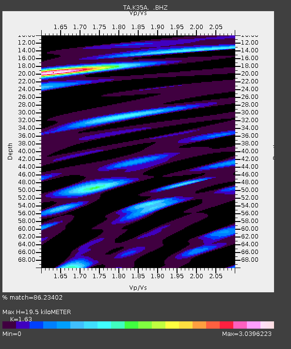
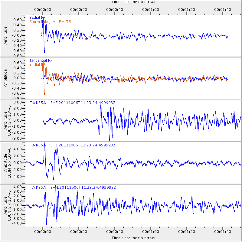
K35A Storm Lake, IA, USA - Earthquake Result Viewer

Earthquake location: Salta Province, Argentina
Earthquake latitude/longitude: -24.2/-64.2
Earthquake time(UTC): 2011/10/06 (279) 11:12:30 GMT
Earthquake Depth: 15 km
Earthquake Magnitude: 6.5 MB, 5.7 MS, 6.1 MW, 5.9 MW
Earthquake Catalog/Contributor: WHDF/NEIC
Network: TA USArray Transportable Network (new EarthScope stations)
Station: K35A Storm Lake, IA, USA
Lat/Lon: 42.72 N/95.23 W
Elevation: 439 m
Distance: 72.5 deg
Az: 336.533 deg
Baz: 150.427 deg
Ray Param: 0.053640977
Estimated Moho Depth: 19.5 km
Estimated Crust Vp/Vs: 1.63
Assumed Crust Vp: 6.53 km/s
Estimated Crust Vs: 4.006 km/s
Estimated Crust Poisson's Ratio: 0.20
Radial Match: 86.23402 %
Radial Bump: 400
Transverse Match: 78.46188 %
Transverse Bump: 400
SOD ConfigId: 424168
Insert Time: 2012-02-04 05:43:27.393 +0000
GWidth: 2.5
Max Bumps: 400
Tol: 0.001

Signal To Noise

ChannelStoNSTALTA
TA:K35A: :BHZ:20111006T11:23:24.499993Z7.5624382.3533685E-63.1119174E-7
TA:K35A: :BHN:20111006T11:23:24.499993Z5.4283811.5217386E-62.8033008E-7
TA:K35A: :BHE:20111006T11:23:24.499993Z4.11832141.0678483E-62.5929214E-7
Arrivals
Ps2.0 SECOND
PpPs7.6 SECOND
PsPs/PpSs9.5 SECOND