
J31A Geddes, SD, USA - Earthquake Result Viewer
| ||||||||||||||||||
| ||||||||||||||||||
| ||||||||||||||||||
|
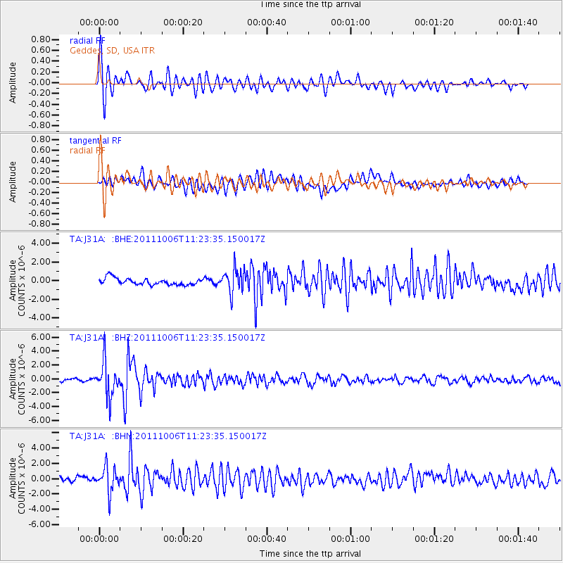
Signal To Noise
| Channel | StoN | STA | LTA |
| TA:J31A: :BHZ:20111006T11:23:35.150017Z | 12.301879 | 2.5243157E-6 | 2.0519758E-7 |
| TA:J31A: :BHN:20111006T11:23:35.150017Z | 4.2546144 | 1.6667047E-6 | 3.9174046E-7 |
| TA:J31A: :BHE:20111006T11:23:35.150017Z | 3.719118 | 1.3223129E-6 | 3.5554476E-7 |
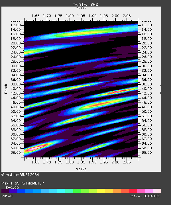
| Arrivals | |
| Ps | 6.8 SECOND |
| PpPs | 26 SECOND |
| PsPs/PpSs | 33 SECOND |

