I33A Coleman, SD, USA - Earthquake Result Viewer
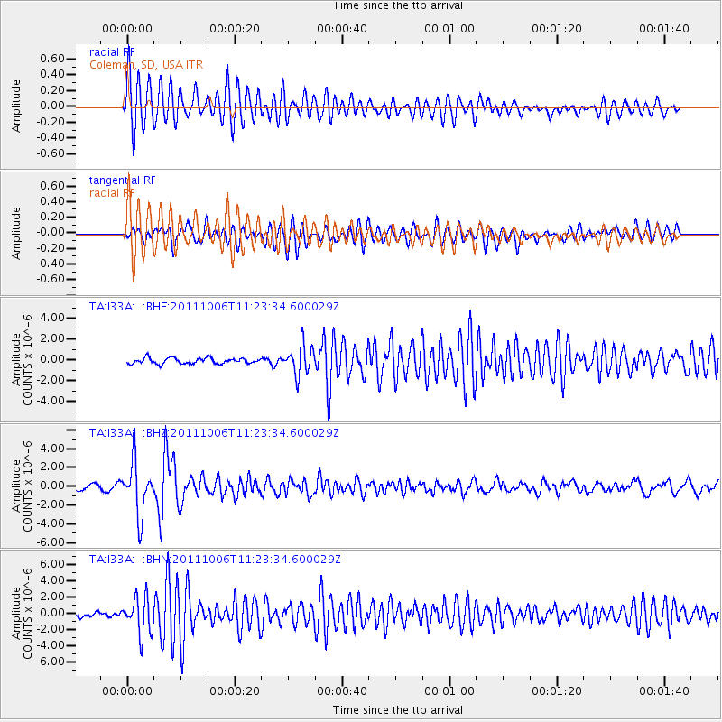
Earthquake location: Salta Province, Argentina
Earthquake latitude/longitude: -24.2/-64.2
Earthquake time(UTC): 2011/10/06 (279) 11:12:30 GMT
Earthquake Depth: 15 km
Earthquake Magnitude: 6.5 MB, 5.7 MS, 6.1 MW, 5.9 MW
Earthquake Catalog/Contributor: WHDF/NEIC
Network: TA USArray Transportable Network (new EarthScope stations)
Station: I33A Coleman, SD, USA
Lat/Lon: 44.05 N/96.80 W
Elevation: 509 m
Distance: 74.2 deg
Az: 336.197 deg
Baz: 149.258 deg
Ray Param: 0.052502934
Estimated Moho Depth: 50.0 km
Estimated Crust Vp/Vs: 1.78
Assumed Crust Vp: 6.552 km/s
Estimated Crust Vs: 3.681 km/s
Estimated Crust Poisson's Ratio: 0.27
Radial Match: 88.53163 %
Radial Bump: 400
Transverse Match: 83.94422 %
Transverse Bump: 400
SOD ConfigId: 424168
Insert Time: 2012-02-04 05:44:22.793 +0000
GWidth: 2.5
Max Bumps: 400
Tol: 0.001

Signal To Noise

ChannelStoNSTALTA
TA:I33A: :BHZ:20111006T11:23:34.600029Z10.5312972.7983558E-62.6571806E-7
TA:I33A: :BHN:20111006T11:23:34.600029Z8.8652382.241295E-62.5281835E-7
TA:I33A: :BHE:20111006T11:23:34.600029Z5.2251921.3944464E-62.6686988E-7
Arrivals
Ps6.2 SECOND
PpPs20 SECOND
PsPs/PpSs27 SECOND