E31A Nome, ND, USA - Earthquake Result Viewer
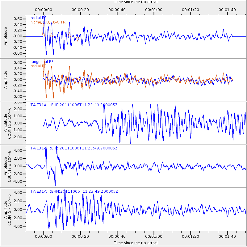
Earthquake location: Salta Province, Argentina
Earthquake latitude/longitude: -24.2/-64.2
Earthquake time(UTC): 2011/10/06 (279) 11:12:30 GMT
Earthquake Depth: 15 km
Earthquake Magnitude: 6.5 MB, 5.7 MS, 6.1 MW, 5.9 MW
Earthquake Catalog/Contributor: WHDF/NEIC
Network: TA USArray Transportable Network (new EarthScope stations)
Station: E31A Nome, ND, USA
Lat/Lon: 46.56 N/97.89 W
Elevation: 427 m
Distance: 76.7 deg
Az: 336.854 deg
Baz: 148.652 deg
Ray Param: 0.050796043
Estimated Moho Depth: 19.0 km
Estimated Crust Vp/Vs: 1.94
Assumed Crust Vp: 6.498 km/s
Estimated Crust Vs: 3.354 km/s
Estimated Crust Poisson's Ratio: 0.32
Radial Match: 89.37361 %
Radial Bump: 332
Transverse Match: 76.94304 %
Transverse Bump: 400
SOD ConfigId: 424168
Insert Time: 2012-02-04 05:45:16.677 +0000
GWidth: 2.5
Max Bumps: 400
Tol: 0.001

Signal To Noise

ChannelStoNSTALTA
TA:E31A: :BHZ:20111006T11:23:49.200005Z6.34987261.9609492E-63.0881708E-7
TA:E31A: :BHN:20111006T11:23:49.200005Z3.39779521.8365968E-65.40526E-7
TA:E31A: :BHE:20111006T11:23:49.200005Z3.20636531.2740106E-63.9733794E-7
Arrivals
Ps2.8 SECOND
PpPs8.3 SECOND
PsPs/PpSs11 SECOND