D34A Park Rapids, MN, USA - Earthquake Result Viewer
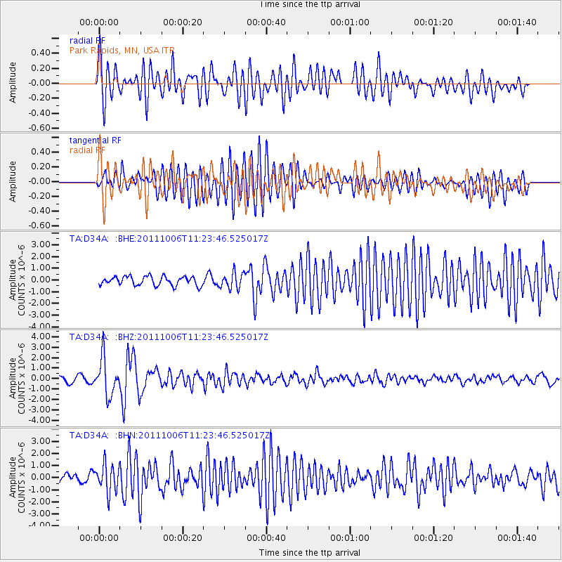
Earthquake location: Salta Province, Argentina
Earthquake latitude/longitude: -24.2/-64.2
Earthquake time(UTC): 2011/10/06 (279) 11:12:30 GMT
Earthquake Depth: 15 km
Earthquake Magnitude: 6.5 MB, 5.7 MS, 6.1 MW, 5.9 MW
Earthquake Catalog/Contributor: WHDF/NEIC
Network: TA USArray Transportable Network (new EarthScope stations)
Station: D34A Park Rapids, MN, USA
Lat/Lon: 47.09 N/95.20 W
Elevation: 476 m
Distance: 76.2 deg
Az: 338.771 deg
Baz: 151.057 deg
Ray Param: 0.05111372
Estimated Moho Depth: 38.0 km
Estimated Crust Vp/Vs: 2.07
Assumed Crust Vp: 6.419 km/s
Estimated Crust Vs: 3.105 km/s
Estimated Crust Poisson's Ratio: 0.35
Radial Match: 82.42294 %
Radial Bump: 400
Transverse Match: 89.080666 %
Transverse Bump: 400
SOD ConfigId: 424168
Insert Time: 2012-02-04 05:46:23.918 +0000
GWidth: 2.5
Max Bumps: 400
Tol: 0.001

Signal To Noise

ChannelStoNSTALTA
TA:D34A: :BHZ:20111006T11:23:46.525017Z6.46939471.8015841E-62.7847798E-7
TA:D34A: :BHN:20111006T11:23:46.525017Z2.87044621.1602556E-64.0420738E-7
TA:D34A: :BHE:20111006T11:23:46.525017Z1.80911546.84032E-73.78103E-7
Arrivals
Ps6.5 SECOND
PpPs18 SECOND
PsPs/PpSs24 SECOND