G32A Webster, SD, USA - Earthquake Result Viewer
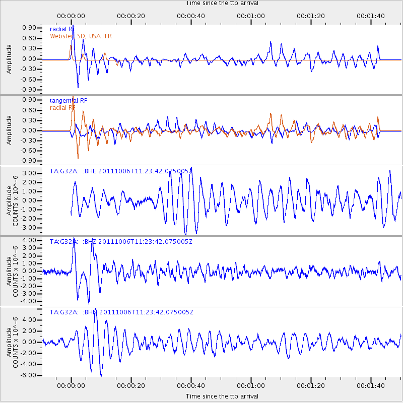
Earthquake location: Salta Province, Argentina
Earthquake latitude/longitude: -24.2/-64.2
Earthquake time(UTC): 2011/10/06 (279) 11:12:30 GMT
Earthquake Depth: 15 km
Earthquake Magnitude: 6.5 MB, 5.7 MS, 6.1 MW, 5.9 MW
Earthquake Catalog/Contributor: WHDF/NEIC
Network: TA USArray Transportable Network (new EarthScope stations)
Station: G32A Webster, SD, USA
Lat/Lon: 45.26 N/97.50 W
Elevation: 566 m
Distance: 75.5 deg
Az: 336.397 deg
Baz: 148.82 deg
Ray Param: 0.05164165
Estimated Moho Depth: 12.5 km
Estimated Crust Vp/Vs: 1.60
Assumed Crust Vp: 6.552 km/s
Estimated Crust Vs: 4.095 km/s
Estimated Crust Poisson's Ratio: 0.18
Radial Match: 87.30185 %
Radial Bump: 390
Transverse Match: 78.3018 %
Transverse Bump: 400
SOD ConfigId: 424168
Insert Time: 2012-02-04 05:47:29.325 +0000
GWidth: 2.5
Max Bumps: 400
Tol: 0.001

Signal To Noise

ChannelStoNSTALTA
TA:G32A: :BHZ:20111006T11:23:42.075005Z7.95534661.932052E-62.428621E-7
TA:G32A: :BHN:20111006T11:23:42.075005Z2.7439121.6103288E-65.8687334E-7
TA:G32A: :BHE:20111006T11:23:42.075005Z2.22366861.8087135E-68.1339164E-7
Arrivals
Ps1.2 SECOND
PpPs4.8 SECOND
PsPs/PpSs6.0 SECOND