
G35A Watkins, MN, USA - Earthquake Result Viewer
| ||||||||||||||||||
| ||||||||||||||||||
| ||||||||||||||||||
|
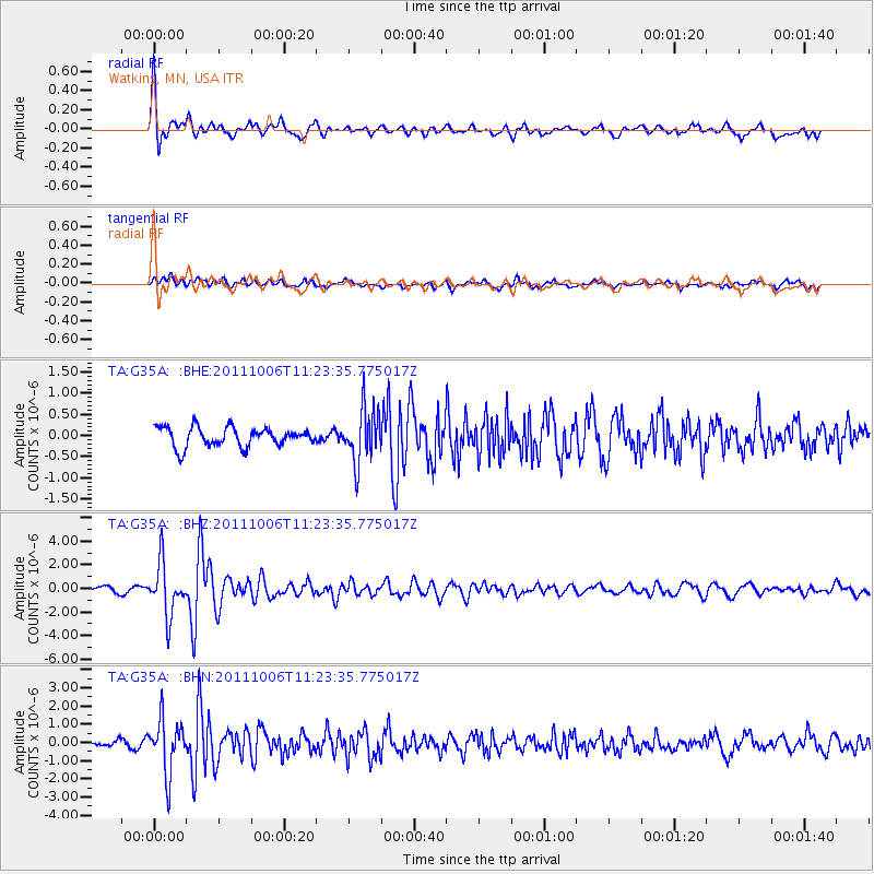
Signal To Noise
| Channel | StoN | STA | LTA |
| TA:G35A: :BHZ:20111006T11:23:35.775017Z | 6.414213 | 2.173106E-6 | 3.387954E-7 |
| TA:G35A: :BHN:20111006T11:23:35.775017Z | 5.7502513 | 1.4701737E-6 | 2.556712E-7 |
| TA:G35A: :BHE:20111006T11:23:35.775017Z | 2.851128 | 6.3404707E-7 | 2.2238461E-7 |
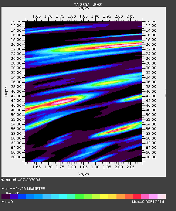
| Arrivals | |
| Ps | 5.3 SECOND |
| PpPs | 18 SECOND |
| PsPs/PpSs | 23 SECOND |

