F32A Veblen, SD, USA - Earthquake Result Viewer
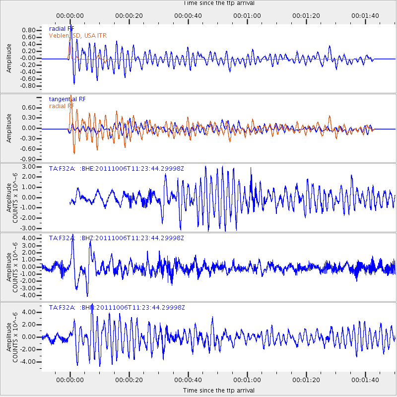
Earthquake location: Salta Province, Argentina
Earthquake latitude/longitude: -24.2/-64.2
Earthquake time(UTC): 2011/10/06 (279) 11:12:30 GMT
Earthquake Depth: 15 km
Earthquake Magnitude: 6.5 MB, 5.7 MS, 6.1 MW, 5.9 MW
Earthquake Catalog/Contributor: WHDF/NEIC
Network: TA USArray Transportable Network (new EarthScope stations)
Station: F32A Veblen, SD, USA
Lat/Lon: 45.87 N/97.13 W
Elevation: 371 m
Distance: 75.9 deg
Az: 336.955 deg
Baz: 149.224 deg
Ray Param: 0.05137642
Estimated Moho Depth: 14.75 km
Estimated Crust Vp/Vs: 2.09
Assumed Crust Vp: 6.552 km/s
Estimated Crust Vs: 3.131 km/s
Estimated Crust Poisson's Ratio: 0.35
Radial Match: 84.08011 %
Radial Bump: 400
Transverse Match: 78.38635 %
Transverse Bump: 400
SOD ConfigId: 424168
Insert Time: 2012-02-04 05:51:26.892 +0000
GWidth: 2.5
Max Bumps: 400
Tol: 0.001

Signal To Noise

ChannelStoNSTALTA
TA:F32A: :BHZ:20111006T11:23:44.29998Z6.50828931.8447028E-62.8343896E-7
TA:F32A: :BHN:20111006T11:23:44.29998Z4.2351141.7434384E-64.1166263E-7
TA:F32A: :BHE:20111006T11:23:44.29998Z2.40352461.0695126E-64.4497673E-7
Arrivals
Ps2.5 SECOND
PpPs6.8 SECOND
PsPs/PpSs9.3 SECOND