You are here: Home > Network List > TA - USArray Transportable Network (new EarthScope stations) Stations List
> Station L37A Phoenix Point, Boone, IA, USA > Earthquake Result Viewer
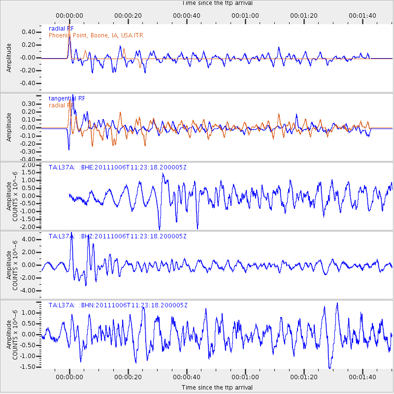
L37A Phoenix Point, Boone, IA, USA - Earthquake Result Viewer
*The percent match for this event was below the threshold and hence no stack was calculated.
| Earthquake location: |
Salta Province, Argentina |
| Earthquake latitude/longitude: |
-24.2/-64.2 |
| Earthquake time(UTC): |
2011/10/06 (279) 11:12:30 GMT |
| Earthquake Depth: |
15 km |
| Earthquake Magnitude: |
6.5 MB, 5.7 MS, 6.1 MW, 5.9 MW |
| Earthquake Catalog/Contributor: |
WHDF/NEIC |
|
| Network: |
TA USArray Transportable Network (new EarthScope stations) |
| Station: |
L37A Phoenix Point, Boone, IA, USA |
| Lat/Lon: |
42.12 N/93.75 W |
| Elevation: |
312 m |
|
| Distance: |
71.4 deg |
| Az: |
337.236 deg |
| Baz: |
151.638 deg |
| Ray Param: |
$rayparam |
*The percent match for this event was below the threshold and hence was not used in the summary stack. |
|
| Radial Match: |
78.38212 % |
| Radial Bump: |
384 |
| Transverse Match: |
73.637344 % |
| Transverse Bump: |
378 |
| SOD ConfigId: |
424168 |
| Insert Time: |
2012-02-04 05:52:10.441 +0000 |
| GWidth: |
2.5 |
| Max Bumps: |
400 |
| Tol: |
0.001 |
|
Signal To Noise
| Channel | StoN | STA | LTA |
| TA:L37A: :BHZ:20111006T11:23:18.200005Z | 6.1548495 | 1.9624636E-6 | 3.1884832E-7 |
| TA:L37A: :BHN:20111006T11:23:18.200005Z | 1.5934248 | 5.462241E-7 | 3.4279878E-7 |
| TA:L37A: :BHE:20111006T11:23:18.200005Z | 2.5541828 | 1.0172033E-6 | 3.9825E-7 |
| Arrivals |
| Ps | |
| PpPs | |
| PsPs/PpSs | |


