Y40A Okolona, AR, USA - Earthquake Result Viewer
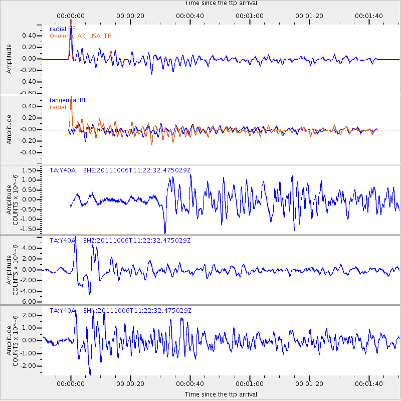
Earthquake location: Salta Province, Argentina
Earthquake latitude/longitude: -24.2/-64.2
Earthquake time(UTC): 2011/10/06 (279) 11:12:30 GMT
Earthquake Depth: 15 km
Earthquake Magnitude: 6.5 MB, 5.7 MS, 6.1 MW, 5.9 MW
Earthquake Catalog/Contributor: WHDF/NEIC
Network: TA USArray Transportable Network (new EarthScope stations)
Station: Y40A Okolona, AR, USA
Lat/Lon: 34.01 N/93.28 W
Elevation: 117 m
Distance: 64.1 deg
Az: 333.358 deg
Baz: 150.46 deg
Ray Param: 0.05911206
Estimated Moho Depth: 33.25 km
Estimated Crust Vp/Vs: 1.74
Assumed Crust Vp: 6.498 km/s
Estimated Crust Vs: 3.729 km/s
Estimated Crust Poisson's Ratio: 0.25
Radial Match: 89.43899 %
Radial Bump: 400
Transverse Match: 79.64463 %
Transverse Bump: 400
SOD ConfigId: 424168
Insert Time: 2012-02-04 05:54:49.729 +0000
GWidth: 2.5
Max Bumps: 400
Tol: 0.001

Signal To Noise

ChannelStoNSTALTA
TA:Y40A: :BHZ:20111006T11:22:32.475029Z14.6221472.4760216E-61.6933366E-7
TA:Y40A: :BHN:20111006T11:22:32.475029Z3.958648.7591224E-72.2126594E-7
TA:Y40A: :BHE:20111006T11:22:32.475029Z5.44047367.6822965E-71.4120639E-7
Arrivals
Ps4.0 SECOND
PpPs13 SECOND
PsPs/PpSs17 SECOND