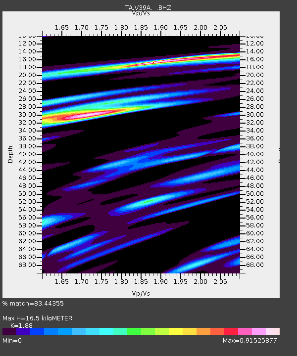
V39A Pettigrew, AR, USA - Earthquake Result Viewer

Earthquake location: Salta Province, Argentina
Earthquake latitude/longitude: -24.2/-64.2
Earthquake time(UTC): 2011/10/06 (279) 11:12:30 GMT
Earthquake Depth: 15 km
Earthquake Magnitude: 6.5 MB, 5.7 MS, 6.1 MW, 5.9 MW
Earthquake Catalog/Contributor: WHDF/NEIC
Network: TA USArray Transportable Network (new EarthScope stations)
Station: V39A Pettigrew, AR, USA
Lat/Lon: 35.84 N/93.64 W
Elevation: 744 m
Distance: 65.9 deg
Az: 334.059 deg
Baz: 150.548 deg
Ray Param: 0.05798253
Estimated Moho Depth: 16.5 km
Estimated Crust Vp/Vs: 1.88
Assumed Crust Vp: 6.498 km/s
Estimated Crust Vs: 3.456 km/s
Estimated Crust Poisson's Ratio: 0.30
Radial Match: 83.44355 %
Radial Bump: 400
Transverse Match: 73.86471 %
Transverse Bump: 400
SOD ConfigId: 424168
Insert Time: 2012-02-04 05:55:33.794 +0000
GWidth: 2.5
Max Bumps: 400
Tol: 0.001

Signal To Noise

ChannelStoNSTALTA
TA:V39A: :BHZ:20111006T11:22:43.725029Z8.5225182.1634412E-62.5385E-7
TA:V39A: :BHN:20111006T11:22:43.725029Z5.2741599.3826566E-71.7789863E-7
TA:V39A: :BHE:20111006T11:22:43.725029Z3.41831337.64437E-72.236299E-7
Arrivals
Ps2.3 SECOND
PpPs7.0 SECOND
PsPs/PpSs9.4 SECOND