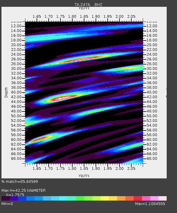
Z47A Carrollton, AL, USA - Earthquake Result Viewer
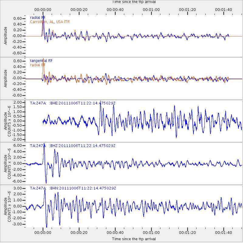
Earthquake location: Salta Province, Argentina
Earthquake latitude/longitude: -24.2/-64.2
Earthquake time(UTC): 2011/10/06 (279) 11:12:30 GMT
Earthquake Depth: 15 km
Earthquake Magnitude: 6.5 MB, 5.7 MS, 6.1 MW, 5.9 MW
Earthquake Catalog/Contributor: WHDF/NEIC
Network: TA USArray Transportable Network (new EarthScope stations)
Station: Z47A Carrollton, AL, USA
Lat/Lon: 33.20 N/88.07 W
Elevation: 65 m
Distance: 61.4 deg
Az: 337.289 deg
Baz: 155.131 deg
Ray Param: 0.060874492
Estimated Moho Depth: 42.25 km
Estimated Crust Vp/Vs: 1.76
Assumed Crust Vp: 6.201 km/s
Estimated Crust Vs: 3.529 km/s
Estimated Crust Poisson's Ratio: 0.26
Radial Match: 85.64599 %
Radial Bump: 400
Transverse Match: 78.71036 %
Transverse Bump: 400
SOD ConfigId: 424168
Insert Time: 2012-02-04 06:08:35.610 +0000
GWidth: 2.5
Max Bumps: 400
Tol: 0.001

Signal To Noise

ChannelStoNSTALTA
TA:Z47A: :BHZ:20111006T11:22:14.475029Z13.2335912.8933634E-62.1863781E-7
TA:Z47A: :BHN:20111006T11:22:14.475029Z5.56713061.4806737E-62.6596715E-7
TA:Z47A: :BHE:20111006T11:22:14.475029Z3.47144729.366937E-72.69828E-7
Arrivals
Ps5.4 SECOND
PpPs18 SECOND
PsPs/PpSs23 SECOND