You are here: Home > Network List > KN - Kyrgyz Seismic Telemetry Network Stations List
> Station UCH - > Earthquake Result Viewer
UCH - - Earthquake Result Viewer

| Earthquake location: |
Solomon Islands |
| Earthquake latitude/longitude: |
-11.3/162.2 |
| Earthquake time(UTC): |
2014/04/12 (102) 20:14:39 GMT |
| Earthquake Depth: |
29 km |
| Earthquake Magnitude: |
7.6 MWW, 8.3 MI |
| Earthquake Catalog/Contributor: |
NEIC PDE/NEIC COMCAT |
|
| Network: |
KN Kyrgyz Seismic Telemetry Network |
| Station: |
UCH - |
| Lat/Lon: |
42.23 N/74.51 E |
| Elevation: |
3850 m |
|
| Distance: |
95.8 deg |
| Az: |
311.758 deg |
| Baz: |
99.907 deg |
| Ray Param: |
0.04067098 |
| Estimated Moho Depth: |
36.25 km |
| Estimated Crust Vp/Vs: |
1.63 |
| Assumed Crust Vp: |
6.306 km/s |
| Estimated Crust Vs: |
3.863 km/s |
| Estimated Crust Poisson's Ratio: |
0.20 |
|
| Radial Match: |
93.89041 % |
| Radial Bump: |
400 |
| Transverse Match: |
76.96488 % |
| Transverse Bump: |
400 |
| SOD ConfigId: |
3390531 |
| Insert Time: |
2019-04-11 08:06:45.897 +0000 |
| GWidth: |
2.5 |
| Max Bumps: |
400 |
| Tol: |
0.001 |
|
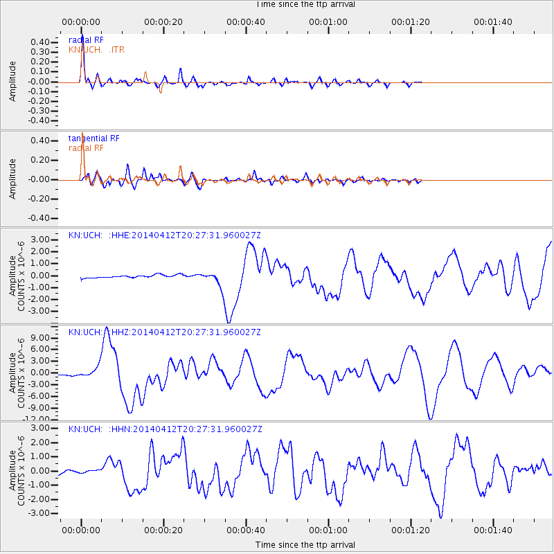
Signal To Noise
| Channel | StoN | STA | LTA |
| KN:UCH: :HHZ:20140412T20:27:31.960027Z | 10.919405 | 1.5900436E-6 | 1.4561631E-7 |
| KN:UCH: :HHN:20140412T20:27:31.960027Z | 0.67180514 | 9.039619E-8 | 1.3455715E-7 |
| KN:UCH: :HHE:20140412T20:27:31.960027Z | 4.1966305 | 5.0695206E-7 | 1.2079978E-7 |
| Arrivals |
| Ps | 3.7 SECOND |
| PpPs | 15 SECOND |
| PsPs/PpSs | 19 SECOND |


