You are here: Home > Network List > TA - USArray Transportable Network (new EarthScope stations) Stations List
> Station J41A Loganville, WI, USA > Earthquake Result Viewer
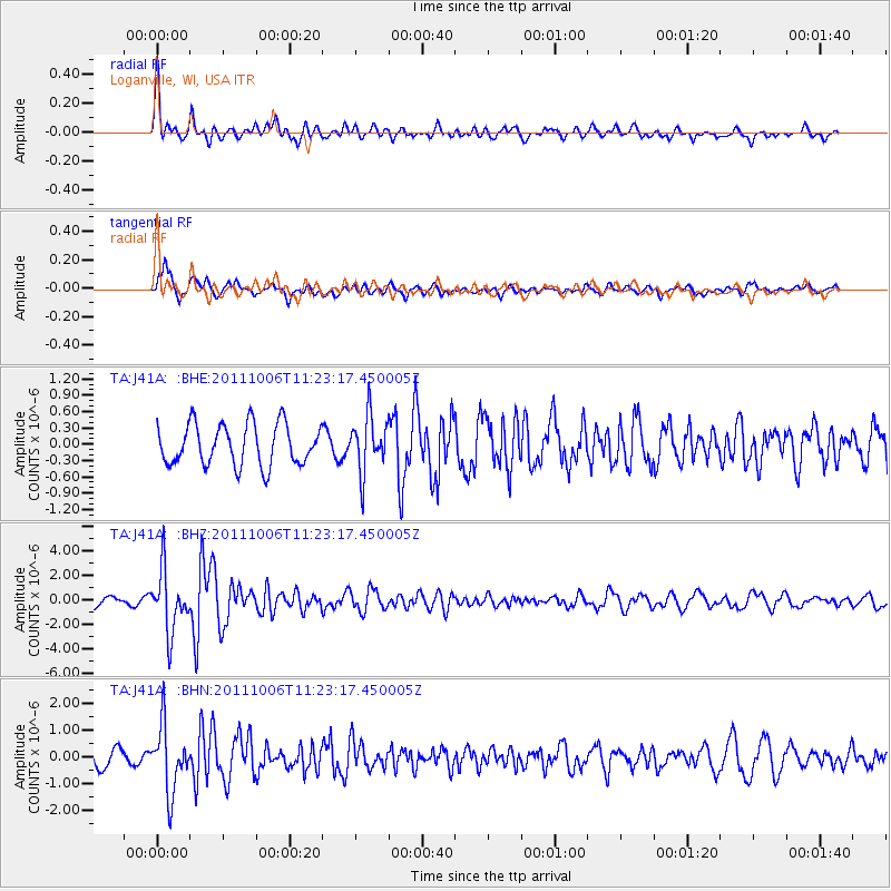
J41A Loganville, WI, USA - Earthquake Result Viewer
*The percent match for this event was below the threshold and hence no stack was calculated.
| Earthquake location: |
Salta Province, Argentina |
| Earthquake latitude/longitude: |
-24.2/-64.2 |
| Earthquake time(UTC): |
2011/10/06 (279) 11:12:30 GMT |
| Earthquake Depth: |
15 km |
| Earthquake Magnitude: |
6.5 MB, 5.7 MS, 6.1 MW, 5.9 MW |
| Earthquake Catalog/Contributor: |
WHDF/NEIC |
|
| Network: |
TA USArray Transportable Network (new EarthScope stations) |
| Station: |
J41A Loganville, WI, USA |
| Lat/Lon: |
43.37 N/90.01 W |
| Elevation: |
360 m |
|
| Distance: |
71.3 deg |
| Az: |
340.422 deg |
| Baz: |
155.189 deg |
| Ray Param: |
$rayparam |
*The percent match for this event was below the threshold and hence was not used in the summary stack. |
|
| Radial Match: |
73.3521 % |
| Radial Bump: |
400 |
| Transverse Match: |
62.530697 % |
| Transverse Bump: |
400 |
| SOD ConfigId: |
424168 |
| Insert Time: |
2012-02-04 06:12:36.281 +0000 |
| GWidth: |
2.5 |
| Max Bumps: |
400 |
| Tol: |
0.001 |
|
Signal To Noise
| Channel | StoN | STA | LTA |
| TA:J41A: :BHZ:20111006T11:23:17.450005Z | 5.1191554 | 2.4843096E-6 | 4.8529677E-7 |
| TA:J41A: :BHN:20111006T11:23:17.450005Z | 3.2699773 | 1.224076E-6 | 3.7433776E-7 |
| TA:J41A: :BHE:20111006T11:23:17.450005Z | 1.3488683 | 5.058393E-7 | 3.7501016E-7 |
| Arrivals |
| Ps | |
| PpPs | |
| PsPs/PpSs | |


