L40A Anamosa, IA, USA - Earthquake Result Viewer
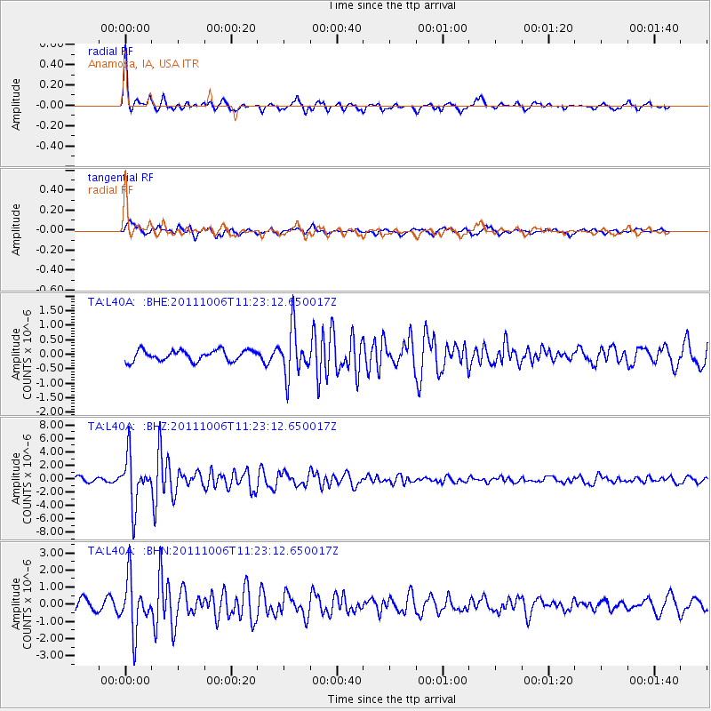
Earthquake location: Salta Province, Argentina
Earthquake latitude/longitude: -24.2/-64.2
Earthquake time(UTC): 2011/10/06 (279) 11:12:30 GMT
Earthquake Depth: 15 km
Earthquake Magnitude: 6.5 MB, 5.7 MS, 6.1 MW, 5.9 MW
Earthquake Catalog/Contributor: WHDF/NEIC
Network: TA USArray Transportable Network (new EarthScope stations)
Station: L40A Anamosa, IA, USA
Lat/Lon: 42.06 N/91.22 W
Elevation: 242 m
Distance: 70.5 deg
Az: 338.979 deg
Baz: 153.899 deg
Ray Param: 0.054943454
Estimated Moho Depth: 17.75 km
Estimated Crust Vp/Vs: 1.77
Assumed Crust Vp: 6.53 km/s
Estimated Crust Vs: 3.69 km/s
Estimated Crust Poisson's Ratio: 0.27
Radial Match: 81.581604 %
Radial Bump: 291
Transverse Match: 77.93394 %
Transverse Bump: 400
SOD ConfigId: 424168
Insert Time: 2012-02-04 06:13:05.060 +0000
GWidth: 2.5
Max Bumps: 400
Tol: 0.001

Signal To Noise

ChannelStoNSTALTA
TA:L40A: :BHZ:20111006T11:23:12.650017Z11.5422023.6495403E-63.16191E-7
TA:L40A: :BHN:20111006T11:23:12.650017Z4.7988031.5352269E-63.1991874E-7
TA:L40A: :BHE:20111006T11:23:12.650017Z4.41863448.1561535E-71.845854E-7
Arrivals
Ps2.2 SECOND
PpPs7.2 SECOND
PsPs/PpSs9.4 SECOND