
U41A Viola, AR, USA - Earthquake Result Viewer
| ||||||||||||||||||
| ||||||||||||||||||
| ||||||||||||||||||
|
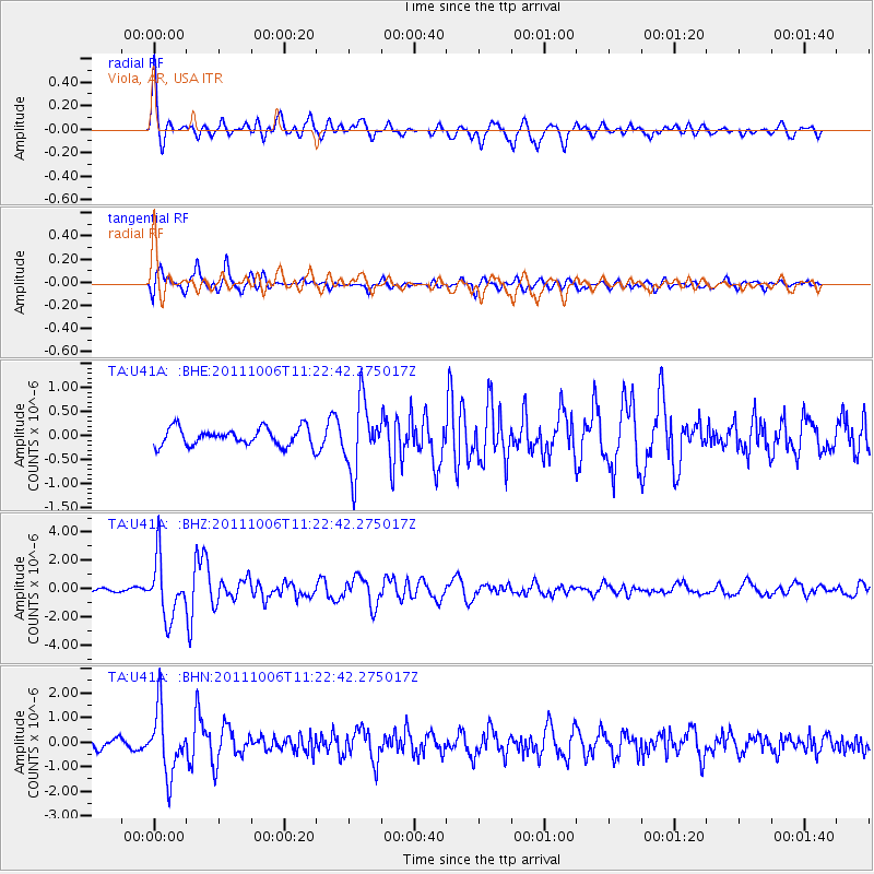
Signal To Noise
| Channel | StoN | STA | LTA |
| TA:U41A: :BHZ:20111006T11:22:42.275017Z | 12.772466 | 2.0682853E-6 | 1.6193313E-7 |
| TA:U41A: :BHN:20111006T11:22:42.275017Z | 6.247292 | 1.2882199E-6 | 2.0620453E-7 |
| TA:U41A: :BHE:20111006T11:22:42.275017Z | 3.928218 | 7.181943E-7 | 1.8282954E-7 |
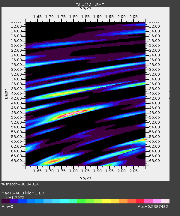
| Arrivals | |
| Ps | 6.1 SECOND |
| PpPs | 20 SECOND |
| PsPs/PpSs | 26 SECOND |

