V43A Jonesboro, AR, USA - Earthquake Result Viewer
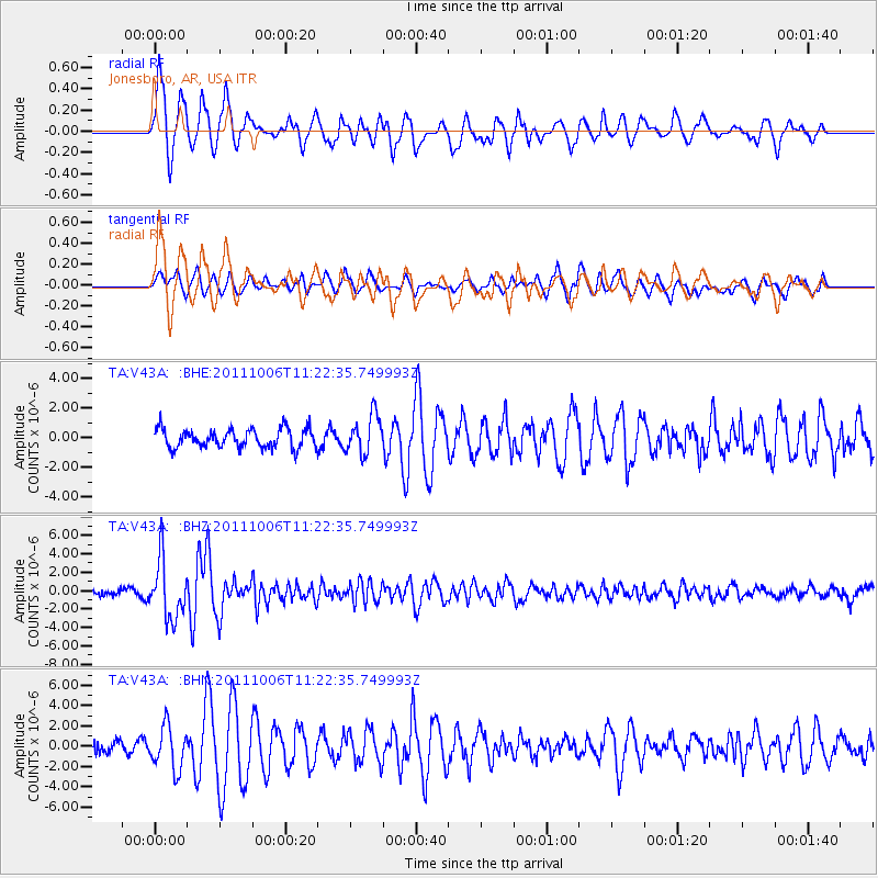
Earthquake location: Salta Province, Argentina
Earthquake latitude/longitude: -24.2/-64.2
Earthquake time(UTC): 2011/10/06 (279) 11:12:30 GMT
Earthquake Depth: 15 km
Earthquake Magnitude: 6.5 MB, 5.7 MS, 6.1 MW, 5.9 MW
Earthquake Catalog/Contributor: WHDF/NEIC
Network: TA USArray Transportable Network (new EarthScope stations)
Station: V43A Jonesboro, AR, USA
Lat/Lon: 35.79 N/90.54 W
Elevation: 74 m
Distance: 64.6 deg
Az: 336.481 deg
Baz: 153.369 deg
Ray Param: 0.05878814
Estimated Moho Depth: 11.5 km
Estimated Crust Vp/Vs: 1.66
Assumed Crust Vp: 6.273 km/s
Estimated Crust Vs: 3.773 km/s
Estimated Crust Poisson's Ratio: 0.22
Radial Match: 90.07078 %
Radial Bump: 400
Transverse Match: 66.55693 %
Transverse Bump: 400
SOD ConfigId: 424168
Insert Time: 2012-02-04 06:14:06.226 +0000
GWidth: 2.5
Max Bumps: 400
Tol: 0.001

Signal To Noise

ChannelStoNSTALTA
TA:V43A: :BHZ:20111006T11:22:35.749993Z13.8076933.170473E-62.2961643E-7
TA:V43A: :BHN:20111006T11:22:35.749993Z3.59453852.1118406E-65.8751374E-7
TA:V43A: :BHE:20111006T11:22:35.749993Z2.03358671.290439E-66.34563E-7
Arrivals
Ps1.3 SECOND
PpPs4.7 SECOND
PsPs/PpSs5.9 SECOND