
U44A Portageville, MO, USA - Earthquake Result Viewer
| ||||||||||||||||||
| ||||||||||||||||||
| ||||||||||||||||||
|
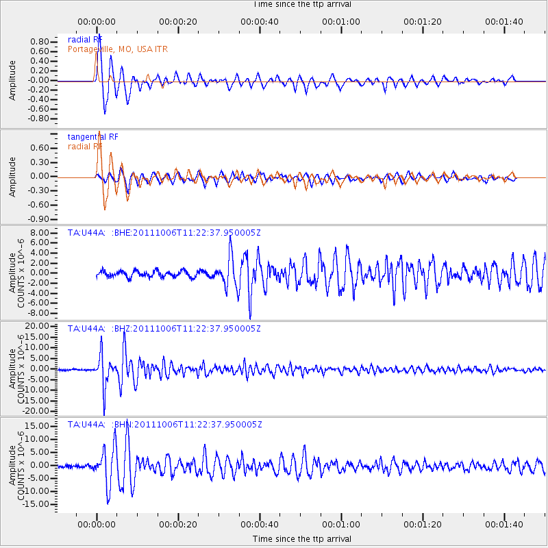
Signal To Noise
| Channel | StoN | STA | LTA |
| TA:U44A: :BHZ:20111006T11:22:37.950005Z | 26.35942 | 7.2192547E-6 | 2.7387762E-7 |
| TA:U44A: :BHN:20111006T11:22:37.950005Z | 9.354114 | 7.424724E-6 | 7.9373893E-7 |
| TA:U44A: :BHE:20111006T11:22:37.950005Z | 5.21846 | 3.112174E-6 | 5.9637784E-7 |
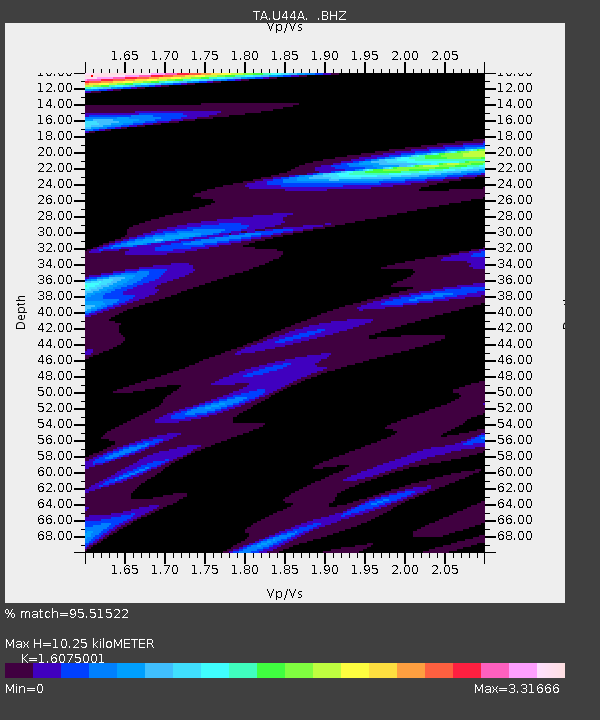
| Arrivals | |
| Ps | 1.0 SECOND |
| PpPs | 4.0 SECOND |
| PsPs/PpSs | 5.0 SECOND |

