You are here: Home > Network List > TA - USArray Transportable Network (new EarthScope stations) Stations List
> Station W42A Bald Knob, AR, USA > Earthquake Result Viewer
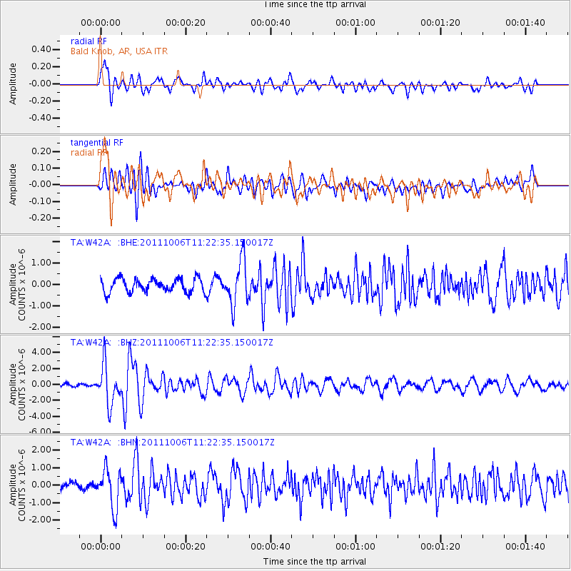
W42A Bald Knob, AR, USA - Earthquake Result Viewer
*The percent match for this event was below the threshold and hence no stack was calculated.
| Earthquake location: |
Salta Province, Argentina |
| Earthquake latitude/longitude: |
-24.2/-64.2 |
| Earthquake time(UTC): |
2011/10/06 (279) 11:12:30 GMT |
| Earthquake Depth: |
15 km |
| Earthquake Magnitude: |
6.5 MB, 5.7 MS, 6.1 MW, 5.9 MW |
| Earthquake Catalog/Contributor: |
WHDF/NEIC |
|
| Network: |
TA USArray Transportable Network (new EarthScope stations) |
| Station: |
W42A Bald Knob, AR, USA |
| Lat/Lon: |
35.27 N/91.52 W |
| Elevation: |
71 m |
|
| Distance: |
64.5 deg |
| Az: |
335.437 deg |
| Baz: |
152.355 deg |
| Ray Param: |
$rayparam |
*The percent match for this event was below the threshold and hence was not used in the summary stack. |
|
| Radial Match: |
78.44099 % |
| Radial Bump: |
400 |
| Transverse Match: |
68.59333 % |
| Transverse Bump: |
400 |
| SOD ConfigId: |
424168 |
| Insert Time: |
2012-02-04 06:14:36.450 +0000 |
| GWidth: |
2.5 |
| Max Bumps: |
400 |
| Tol: |
0.001 |
|
Signal To Noise
| Channel | StoN | STA | LTA |
| TA:W42A: :BHZ:20111006T11:22:35.150017Z | 6.561183 | 2.518864E-6 | 3.8390394E-7 |
| TA:W42A: :BHN:20111006T11:22:35.150017Z | 5.191576 | 1.128647E-6 | 2.1739969E-7 |
| TA:W42A: :BHE:20111006T11:22:35.150017Z | 3.3081846 | 1.0513049E-6 | 3.1778907E-7 |
| Arrivals |
| Ps | |
| PpPs | |
| PsPs/PpSs | |


