You are here: Home > Network List > TA - USArray Transportable Network (new EarthScope stations) Stations List
> Station F39A Loretta, WI, USA > Earthquake Result Viewer
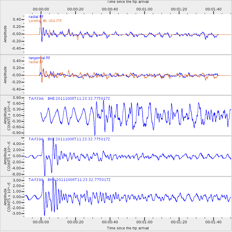
F39A Loretta, WI, USA - Earthquake Result Viewer
*The percent match for this event was below the threshold and hence no stack was calculated.
| Earthquake location: |
Salta Province, Argentina |
| Earthquake latitude/longitude: |
-24.2/-64.2 |
| Earthquake time(UTC): |
2011/10/06 (279) 11:12:30 GMT |
| Earthquake Depth: |
15 km |
| Earthquake Magnitude: |
6.5 MB, 5.7 MS, 6.1 MW, 5.9 MW |
| Earthquake Catalog/Contributor: |
WHDF/NEIC |
|
| Network: |
TA USArray Transportable Network (new EarthScope stations) |
| Station: |
F39A Loretta, WI, USA |
| Lat/Lon: |
45.92 N/90.92 W |
| Elevation: |
440 m |
|
| Distance: |
73.9 deg |
| Az: |
340.94 deg |
| Baz: |
154.71 deg |
| Ray Param: |
$rayparam |
*The percent match for this event was below the threshold and hence was not used in the summary stack. |
|
| Radial Match: |
72.637344 % |
| Radial Bump: |
306 |
| Transverse Match: |
69.17002 % |
| Transverse Bump: |
349 |
| SOD ConfigId: |
424168 |
| Insert Time: |
2012-02-04 06:18:00.105 +0000 |
| GWidth: |
2.5 |
| Max Bumps: |
400 |
| Tol: |
0.001 |
|
Signal To Noise
| Channel | StoN | STA | LTA |
| TA:F39A: :BHZ:20111006T11:23:32.775017Z | 10.130827 | 2.5924808E-6 | 2.559002E-7 |
| TA:F39A: :BHN:20111006T11:23:32.775017Z | 5.919941 | 1.4504603E-6 | 2.4501264E-7 |
| TA:F39A: :BHE:20111006T11:23:32.775017Z | 1.6432207 | 4.0189454E-7 | 2.4457734E-7 |
| Arrivals |
| Ps | |
| PpPs | |
| PsPs/PpSs | |


