You are here: Home > Network List > CI - Caltech Regional Seismic Network Stations List
> Station SWS Sam W. Stewart, Westmorland, CA, USA > Earthquake Result Viewer
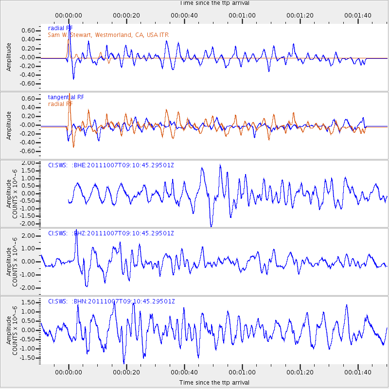
SWS Sam W. Stewart, Westmorland, CA, USA - Earthquake Result Viewer
*The percent match for this event was below the threshold and hence no stack was calculated.
| Earthquake location: |
South Of Kermadec Islands |
| Earthquake latitude/longitude: |
-32.5/-179.0 |
| Earthquake time(UTC): |
2011/10/07 (280) 08:58:28 GMT |
| Earthquake Depth: |
36 km |
| Earthquake Magnitude: |
5.9 MB, 5.8 MS, 6.1 MW, 6.1 MW |
| Earthquake Catalog/Contributor: |
WHDF/NEIC |
|
| Network: |
CI Caltech Regional Seismic Network |
| Station: |
SWS Sam W. Stewart, Westmorland, CA, USA |
| Lat/Lon: |
32.94 N/115.80 W |
| Elevation: |
140 m |
|
| Distance: |
88.3 deg |
| Az: |
48.694 deg |
| Baz: |
229.005 deg |
| Ray Param: |
$rayparam |
*The percent match for this event was below the threshold and hence was not used in the summary stack. |
|
| Radial Match: |
79.566666 % |
| Radial Bump: |
400 |
| Transverse Match: |
57.496605 % |
| Transverse Bump: |
400 |
| SOD ConfigId: |
424168 |
| Insert Time: |
2012-02-04 06:42:38.552 +0000 |
| GWidth: |
2.5 |
| Max Bumps: |
400 |
| Tol: |
0.001 |
|
Signal To Noise
| Channel | StoN | STA | LTA |
| CI:SWS: :BHZ:20111007T09:10:45.29501Z | 2.3000696 | 8.2999765E-7 | 3.6085763E-7 |
| CI:SWS: :BHN:20111007T09:10:45.29501Z | 0.82378227 | 5.1547926E-7 | 6.2574696E-7 |
| CI:SWS: :BHE:20111007T09:10:45.29501Z | 0.7625729 | 3.1403232E-7 | 4.1180633E-7 |
| Arrivals |
| Ps | |
| PpPs | |
| PsPs/PpSs | |


