You are here: Home > Network List > CI - Caltech Regional Seismic Network Stations List
> Station MPP McPhearson Peak > Earthquake Result Viewer
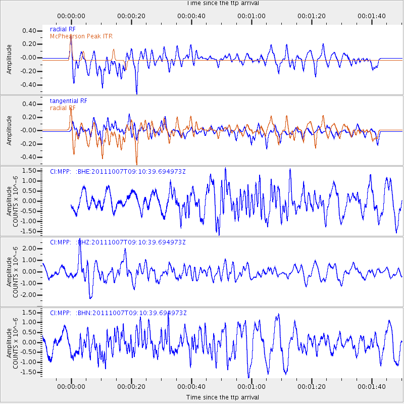
MPP McPhearson Peak - Earthquake Result Viewer
*The percent match for this event was below the threshold and hence no stack was calculated.
| Earthquake location: |
South Of Kermadec Islands |
| Earthquake latitude/longitude: |
-32.5/-179.0 |
| Earthquake time(UTC): |
2011/10/07 (280) 08:58:28 GMT |
| Earthquake Depth: |
36 km |
| Earthquake Magnitude: |
5.9 MB, 5.8 MS, 6.1 MW, 6.1 MW |
| Earthquake Catalog/Contributor: |
WHDF/NEIC |
|
| Network: |
CI Caltech Regional Seismic Network |
| Station: |
MPP McPhearson Peak |
| Lat/Lon: |
34.89 N/119.81 W |
| Elevation: |
1739 m |
|
| Distance: |
87.1 deg |
| Az: |
45.008 deg |
| Baz: |
226.623 deg |
| Ray Param: |
$rayparam |
*The percent match for this event was below the threshold and hence was not used in the summary stack. |
|
| Radial Match: |
60.594933 % |
| Radial Bump: |
400 |
| Transverse Match: |
55.390015 % |
| Transverse Bump: |
400 |
| SOD ConfigId: |
424168 |
| Insert Time: |
2012-02-04 06:44:41.434 +0000 |
| GWidth: |
2.5 |
| Max Bumps: |
400 |
| Tol: |
0.001 |
|
Signal To Noise
| Channel | StoN | STA | LTA |
| CI:MPP: :BHZ:20111007T09:10:39.694973Z | 2.2633874 | 9.334571E-7 | 4.1241594E-7 |
| CI:MPP: :BHN:20111007T09:10:39.694973Z | 0.8652038 | 4.3746155E-7 | 5.056168E-7 |
| CI:MPP: :BHE:20111007T09:10:39.694973Z | 1.3824855 | 5.244966E-7 | 3.793867E-7 |
| Arrivals |
| Ps | |
| PpPs | |
| PsPs/PpSs | |


