You are here: Home > Network List > CI - Caltech Regional Seismic Network Stations List
> Station LGU LGU, Camarillo, CA, USA > Earthquake Result Viewer
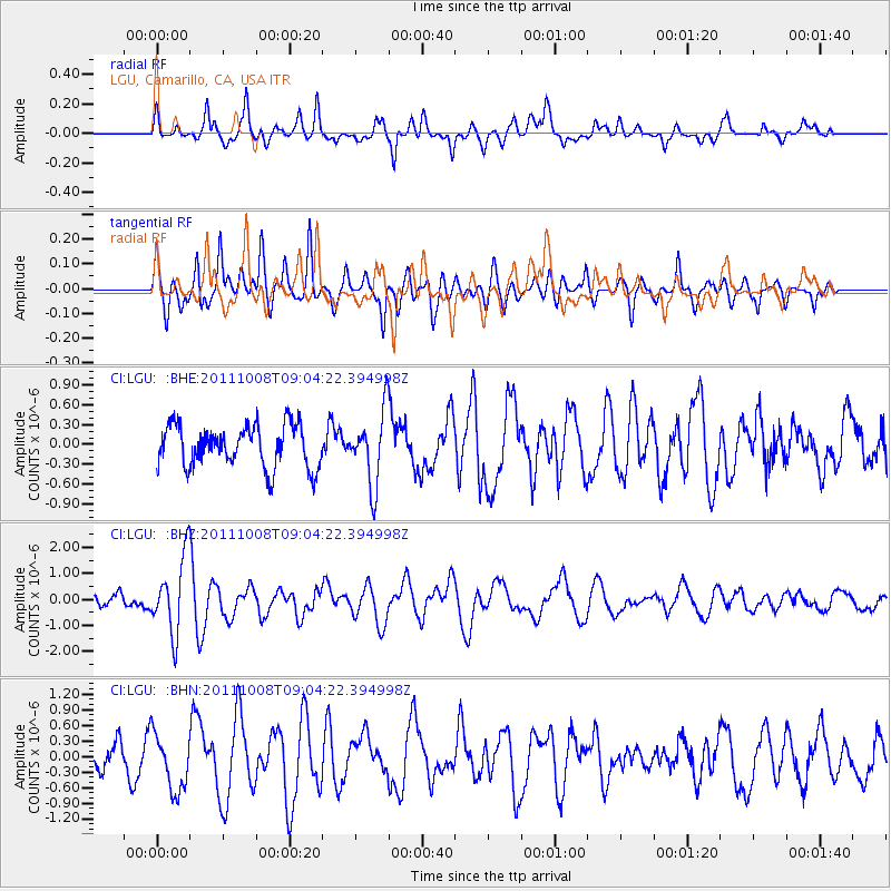
LGU LGU, Camarillo, CA, USA - Earthquake Result Viewer
*The percent match for this event was below the threshold and hence no stack was calculated.
| Earthquake location: |
Tonga Islands |
| Earthquake latitude/longitude: |
-20.6/-173.2 |
| Earthquake time(UTC): |
2011/10/08 (281) 08:53:11 GMT |
| Earthquake Depth: |
6.0 km |
| Earthquake Magnitude: |
6.1 MB, 5.6 MS, 5.9 MW, 5.9 MW |
| Earthquake Catalog/Contributor: |
WHDF/NEIC |
|
| Network: |
CI Caltech Regional Seismic Network |
| Station: |
LGU LGU, Camarillo, CA, USA |
| Lat/Lon: |
34.11 N/119.07 W |
| Elevation: |
416 m |
|
| Distance: |
74.9 deg |
| Az: |
44.149 deg |
| Baz: |
231.853 deg |
| Ray Param: |
$rayparam |
*The percent match for this event was below the threshold and hence was not used in the summary stack. |
|
| Radial Match: |
59.616993 % |
| Radial Bump: |
352 |
| Transverse Match: |
65.50602 % |
| Transverse Bump: |
400 |
| SOD ConfigId: |
424168 |
| Insert Time: |
2012-02-08 01:06:11.453 +0000 |
| GWidth: |
2.5 |
| Max Bumps: |
400 |
| Tol: |
0.001 |
|
Signal To Noise
| Channel | StoN | STA | LTA |
| CI:LGU: :BHZ:20111008T09:04:22.394998Z | 5.084657 | 1.4403785E-6 | 2.8327938E-7 |
| CI:LGU: :BHN:20111008T09:04:22.394998Z | 2.0269897 | 5.527977E-7 | 2.7271858E-7 |
| CI:LGU: :BHE:20111008T09:04:22.394998Z | 1.7506907 | 5.5419076E-7 | 3.1655551E-7 |
| Arrivals |
| Ps | |
| PpPs | |
| PsPs/PpSs | |


