You are here: Home > Network List > CI - Caltech Regional Seismic Network Stations List
> Station SMM Simmler, CA, USA > Earthquake Result Viewer
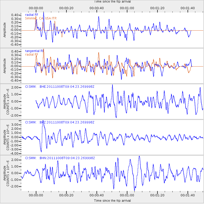
SMM Simmler, CA, USA - Earthquake Result Viewer
*The percent match for this event was below the threshold and hence no stack was calculated.
| Earthquake location: |
Tonga Islands |
| Earthquake latitude/longitude: |
-20.6/-173.2 |
| Earthquake time(UTC): |
2011/10/08 (281) 08:53:11 GMT |
| Earthquake Depth: |
6.0 km |
| Earthquake Magnitude: |
6.1 MB, 5.6 MS, 5.9 MW, 5.9 MW |
| Earthquake Catalog/Contributor: |
WHDF/NEIC |
|
| Network: |
CI Caltech Regional Seismic Network |
| Station: |
SMM Simmler, CA, USA |
| Lat/Lon: |
35.31 N/120.00 W |
| Elevation: |
599 m |
|
| Distance: |
75.1 deg |
| Az: |
42.681 deg |
| Baz: |
230.946 deg |
| Ray Param: |
$rayparam |
*The percent match for this event was below the threshold and hence was not used in the summary stack. |
|
| Radial Match: |
68.53379 % |
| Radial Bump: |
400 |
| Transverse Match: |
67.67124 % |
| Transverse Bump: |
400 |
| SOD ConfigId: |
424168 |
| Insert Time: |
2012-02-08 01:06:40.713 +0000 |
| GWidth: |
2.5 |
| Max Bumps: |
400 |
| Tol: |
0.001 |
|
Signal To Noise
| Channel | StoN | STA | LTA |
| CI:SMM: :BHZ:20111008T09:04:23.269998Z | 6.0872583 | 1.8816656E-6 | 3.0911545E-7 |
| CI:SMM: :BHN:20111008T09:04:23.269998Z | 1.6266445 | 6.7210993E-7 | 4.1318796E-7 |
| CI:SMM: :BHE:20111008T09:04:23.269998Z | 1.6055692 | 7.2796536E-7 | 4.5340016E-7 |
| Arrivals |
| Ps | |
| PpPs | |
| PsPs/PpSs | |


