You are here: Home > Network List > CI - Caltech Regional Seismic Network Stations List
> Station MUR Murrieta > Earthquake Result Viewer
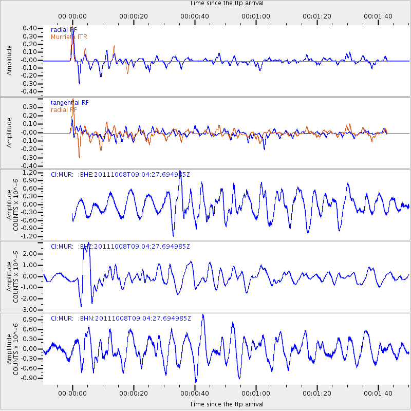
MUR Murrieta - Earthquake Result Viewer
*The percent match for this event was below the threshold and hence no stack was calculated.
| Earthquake location: |
Tonga Islands |
| Earthquake latitude/longitude: |
-20.6/-173.2 |
| Earthquake time(UTC): |
2011/10/08 (281) 08:53:11 GMT |
| Earthquake Depth: |
6.0 km |
| Earthquake Magnitude: |
6.1 MB, 5.6 MS, 5.9 MW, 5.9 MW |
| Earthquake Catalog/Contributor: |
WHDF/NEIC |
|
| Network: |
CI Caltech Regional Seismic Network |
| Station: |
MUR Murrieta |
| Lat/Lon: |
33.60 N/117.20 W |
| Elevation: |
562 m |
|
| Distance: |
75.9 deg |
| Az: |
45.543 deg |
| Baz: |
233.242 deg |
| Ray Param: |
$rayparam |
*The percent match for this event was below the threshold and hence was not used in the summary stack. |
|
| Radial Match: |
77.57573 % |
| Radial Bump: |
400 |
| Transverse Match: |
74.45964 % |
| Transverse Bump: |
400 |
| SOD ConfigId: |
424168 |
| Insert Time: |
2012-02-08 01:08:28.107 +0000 |
| GWidth: |
2.5 |
| Max Bumps: |
400 |
| Tol: |
0.001 |
|
Signal To Noise
| Channel | StoN | STA | LTA |
| CI:MUR: :BHZ:20111008T09:04:27.694985Z | 6.7989526 | 1.5391014E-6 | 2.2637332E-7 |
| CI:MUR: :BHN:20111008T09:04:27.694985Z | 2.393491 | 3.240391E-7 | 1.3538344E-7 |
| CI:MUR: :BHE:20111008T09:04:27.694985Z | 1.605974 | 4.9202737E-7 | 3.0637318E-7 |
| Arrivals |
| Ps | |
| PpPs | |
| PsPs/PpSs | |


