You are here: Home > Network List > TA - USArray Transportable Network (new EarthScope stations) Stations List
> Station G05D Wamic, OR, USA > Earthquake Result Viewer
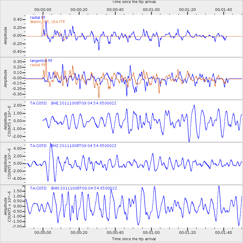
G05D Wamic, OR, USA - Earthquake Result Viewer
*The percent match for this event was below the threshold and hence no stack was calculated.
| Earthquake location: |
Tonga Islands |
| Earthquake latitude/longitude: |
-20.6/-173.2 |
| Earthquake time(UTC): |
2011/10/08 (281) 08:53:11 GMT |
| Earthquake Depth: |
6.0 km |
| Earthquake Magnitude: |
6.1 MB, 5.6 MS, 5.9 MW, 5.9 MW |
| Earthquake Catalog/Contributor: |
WHDF/NEIC |
|
| Network: |
TA USArray Transportable Network (new EarthScope stations) |
| Station: |
G05D Wamic, OR, USA |
| Lat/Lon: |
45.24 N/121.32 W |
| Elevation: |
592 m |
|
| Distance: |
80.7 deg |
| Az: |
34.287 deg |
| Baz: |
228.33 deg |
| Ray Param: |
$rayparam |
*The percent match for this event was below the threshold and hence was not used in the summary stack. |
|
| Radial Match: |
73.60686 % |
| Radial Bump: |
399 |
| Transverse Match: |
72.37685 % |
| Transverse Bump: |
400 |
| SOD ConfigId: |
424168 |
| Insert Time: |
2012-02-08 01:16:55.873 +0000 |
| GWidth: |
2.5 |
| Max Bumps: |
400 |
| Tol: |
0.001 |
|
Signal To Noise
| Channel | StoN | STA | LTA |
| TA:G05D: :BHZ:20111008T09:04:54.650002Z | 6.2363496 | 2.694028E-6 | 4.3198796E-7 |
| TA:G05D: :BHN:20111008T09:04:54.650002Z | 0.4915474 | 3.2884347E-7 | 6.6899645E-7 |
| TA:G05D: :BHE:20111008T09:04:54.650002Z | 0.93897325 | 4.875206E-7 | 5.19206E-7 |
| Arrivals |
| Ps | |
| PpPs | |
| PsPs/PpSs | |


