You are here: Home > Network List > TA - USArray Transportable Network (new EarthScope stations) Stations List
> Station V37A Hulbert, OK, USA > Earthquake Result Viewer
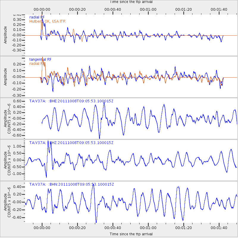
V37A Hulbert, OK, USA - Earthquake Result Viewer
*The percent match for this event was below the threshold and hence no stack was calculated.
| Earthquake location: |
Tonga Islands |
| Earthquake latitude/longitude: |
-20.6/-173.2 |
| Earthquake time(UTC): |
2011/10/08 (281) 08:53:11 GMT |
| Earthquake Depth: |
6.0 km |
| Earthquake Magnitude: |
6.1 MB, 5.6 MS, 5.9 MW, 5.9 MW |
| Earthquake Catalog/Contributor: |
WHDF/NEIC |
|
| Network: |
TA USArray Transportable Network (new EarthScope stations) |
| Station: |
V37A Hulbert, OK, USA |
| Lat/Lon: |
35.88 N/95.14 W |
| Elevation: |
219 m |
|
| Distance: |
92.7 deg |
| Az: |
52.698 deg |
| Baz: |
246.583 deg |
| Ray Param: |
$rayparam |
*The percent match for this event was below the threshold and hence was not used in the summary stack. |
|
| Radial Match: |
56.24341 % |
| Radial Bump: |
400 |
| Transverse Match: |
61.669018 % |
| Transverse Bump: |
400 |
| SOD ConfigId: |
424168 |
| Insert Time: |
2012-02-08 01:25:24.396 +0000 |
| GWidth: |
2.5 |
| Max Bumps: |
400 |
| Tol: |
0.001 |
|
Signal To Noise
| Channel | StoN | STA | LTA |
| TA:V37A: :BHZ:20111008T09:05:53.100015Z | 4.294317 | 7.050467E-7 | 1.6418134E-7 |
| TA:V37A: :BHN:20111008T09:05:53.100015Z | 1.6178112 | 2.130992E-7 | 1.3172068E-7 |
| TA:V37A: :BHE:20111008T09:05:53.100015Z | 1.7259347 | 3.5494045E-7 | 2.0565113E-7 |
| Arrivals |
| Ps | |
| PpPs | |
| PsPs/PpSs | |


